Ничего не найдено
Исследовать
Log in

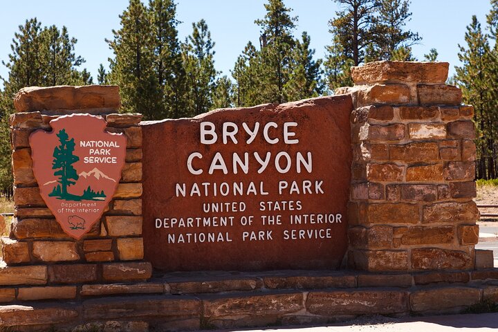
Аудио-тур по национальному парку Брайс-Каньон

Обзор
Рекомендуется: покупайте один тур на машину, а не на человека. Все слушают вместе!

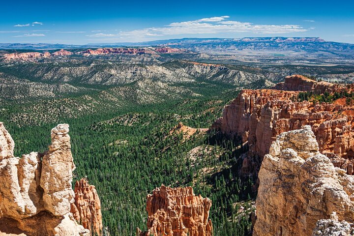
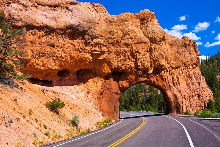
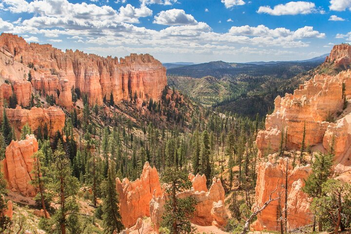
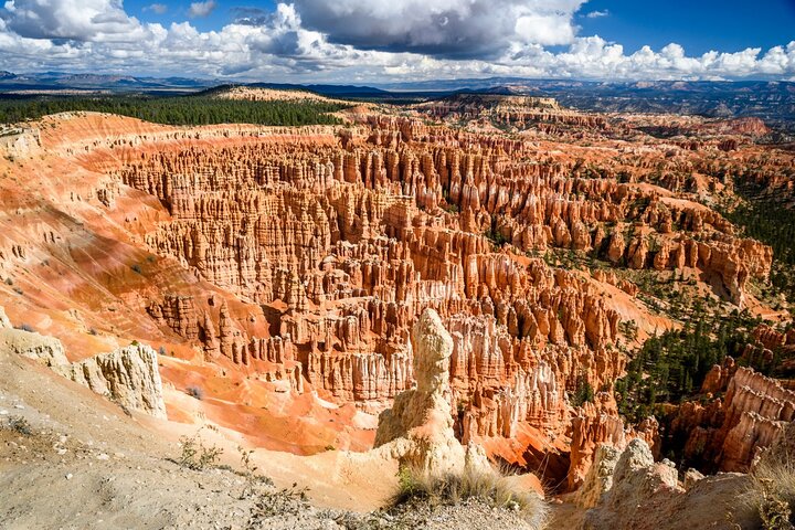
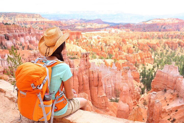
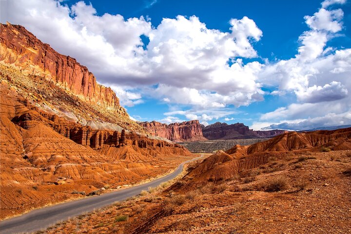
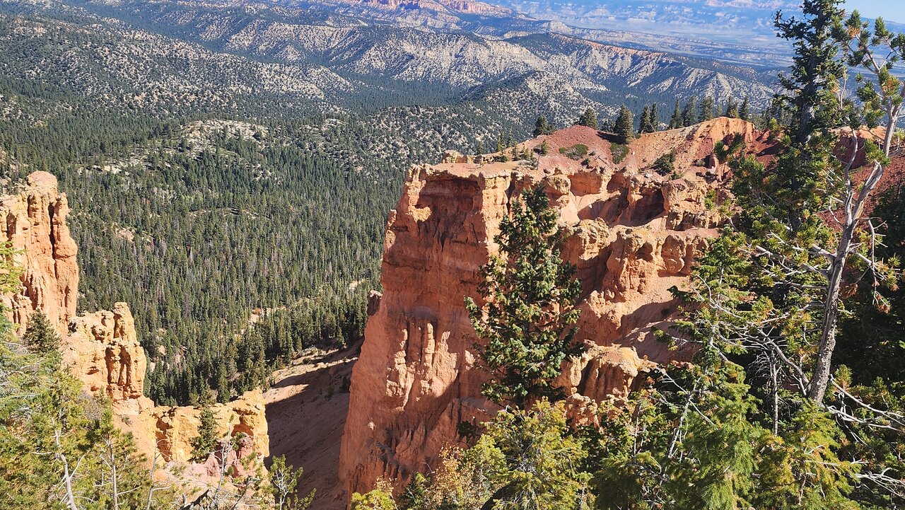
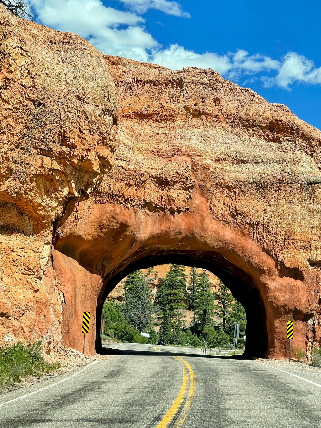
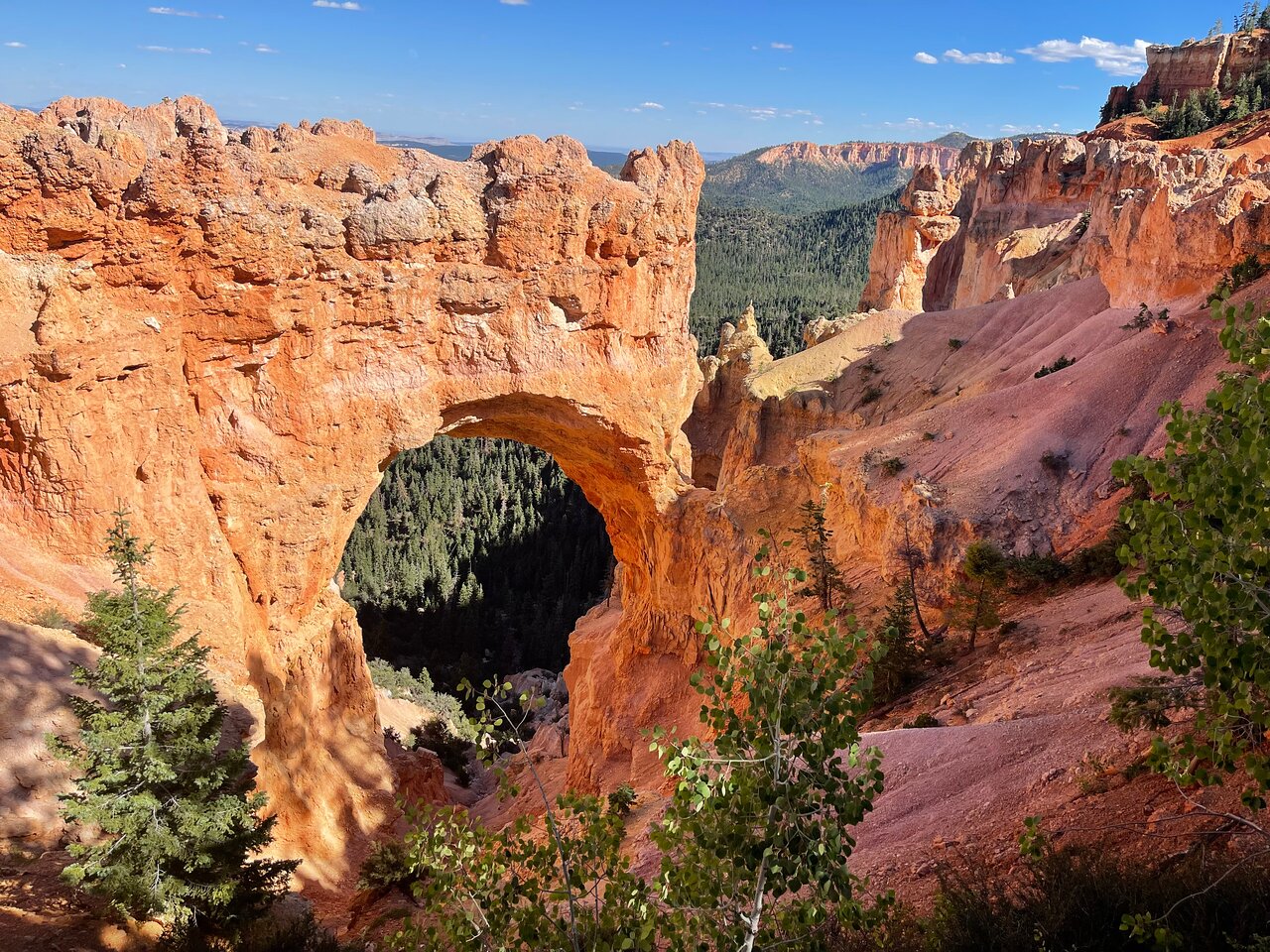
Погрузитесь в невероятные пейзажи национального парка Брайс-Каньон, одного из знаковых парков «Могучей пятерки» штата Юта. В этом автопутешествии с гидом вы сможете исследовать потрясающие виды этого парка и знаменитые худу. Узнайте о великих геологических движениях, сформировавших этот инопланетный ландшафт, проезжая вдоль амфитеатра Брайса и отправляясь на прогулки и походы по каньону. Эта самостоятельная экскурсия позволит вам исследовать чудеса Брайса с максимальной гибкостью и ценностью.

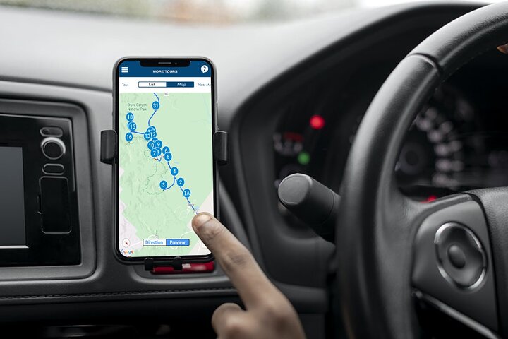
В течение 30 минут мы вышлем вам две вещи: уникальный пароль и приложение. Загрузите приложение на свой телефон, введите пароль и загрузите тур внутри. Когда вы приедете, направляйтесь к первой остановке. Придерживайтесь рекомендуемого нами маршрута и ограничения скорости для получения наилучших впечатлений.

Это не входной билет. Проверьте часы работы и правила covid перед посещением.

Без срока действия — тур действует пожизненно!

Город: Национальный парк Брайс-Каньон
Sat 25 Jan
i
Выбрать дату можно уже на сайте бронирования
Начинается с $10.00
Sat 25 Jan
Начинается с $10.00
Зарезервировать
Что включено
Offline use: No cell signal or wifi required. Offline GPS Map & route. Stop-to-stop direction.
Private tour in your/rental car: No group. Take breaks for photos/ snacks/hikes. Go at your own pace
Don’t miss a thing: Full itinerary, travel tips, professionally narrated hidden stories, video, text
Flexible schedule: Use any day, any time. Travel over multiple days or on next trip. Never expires.
Good value: Buy just one per car. Don’t pay for each person. Save money compared to a bus tour.
App on your phone: A link to download the Action Guide app. Password for your tours. Preview at home
Easy to use: Stories play automatically by GPS. Hands-free. Get HELP all day: Call, Chat or Email.
Дополнительная информация
  • Остановки общественного транспорта поблизости.
  • Подходит для всех уровней физической подготовки.
  • Как это работает: после бронирования тура вы получите текстовое/электронное письмо. с инструкциями. Загрузите приложение (при хорошем Wi-Fi/сигнале) и используйте свой уникальный пароль для доступа к своим турам. Чтобы начать тур, перейдите в Начальную точку и запустите приложение. Звук запускается автоматически. Придерживайтесь маршрута тура и ограничения скорости для получения наилучших впечатлений. Обратите внимание, что никто не встретит вас в начальной точке.
  • Выгодное соотношение цены и качества Приобретите только один тур на весь автомобиль вместо того, чтобы садиться в автобус и платить за каждого человека. Вы увидите существенную экономию. Подключите телефон к динамикам автомобиля по проводу или Bluetooth. Наслаждайтесь туром, слушая его вместе во время вождения.
  • Гибкий график: как только приложение/тур появится на вашем телефоне, вы сможете использовать его в любой день и в любое время. Вы можете использовать его в течение нескольких дней. А также используйте его в своей следующей поездке сюда. Этот тур не имеет срока действия.
  • Предварительный просмотр тура: вы можете использовать его перед поездкой дома (настоятельно рекомендуется), использовать его во время поездки и использовать его после возвращения.
  • >Ничего не упустите: с приложением вы получите все: полный маршрут, советы путешественникам, профессионально озвученные аудиоистории, сценарий рассказа, изображения, видео, глубокие погружения, скрытые жемчужины, захватывающие места, рекомендации для походов, приключений, мероприятия, походы и направление с остановками.
  • Частный тур: вы можете использовать его в своем автомобиле или арендованном автомобиле. Не беспокойтесь о группах или толпе. Запустите приложение тура на своем телефоне. И будет направлять вас шаг за шагом. Вы можете останавливаться на столько перерывов, сколько захотите. Сделайте перерыв на фотографии в Instagram и сделайте перерыв на обед/перекус. Отправляйтесь в поход. Тур будет ждать вас и начнется, когда вы начнете снова. Вы даже можете сделать тур в течение нескольких дней. Идите в своем собственном темпе.
  • Простота в использовании: истории воспроизводятся сами собой, как только активируется GPS. Он вообще не требует использования ваших рук. Вы можете получить ПОМОЩЬ по телефону, в чате или по электронной почте в любое время дня.
  • Не в сети: во время гастролей нет необходимости в сотовом сигнале или Wi-Fi. GPS-карта приложения работает в автономном режиме.
  • Истечение срока действия/начать снова: тур будет длиться до конца вашей жизни на вашем телефоне. Его можно использовать в любой день вашей следующей поездки.
  • Используйте фотографии для фотокниги: создайте фотокнигу, используя чистые (без скопления людей) изображения каждого места в приложении, чтобы сделать поездку незабываемой. Все фотографии и правильная последовательность готовы для использования в приложении.
  • Социальные сети: делитесь чистыми (без толпы) изображениями с друзьями/родными.
  • Поддерживаемые устройства включают iPhone с iOS 13 и выше, телефоны Android с версией 9 и выше, а также все планшеты и iPad с поддержкой сотовой связи.
  • Для путешественников в общественных местах требуются маски для лица
  • ли>
Что ожидать
1
Bryce Canyon National Park
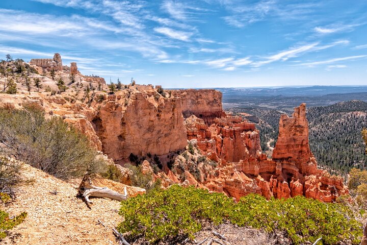
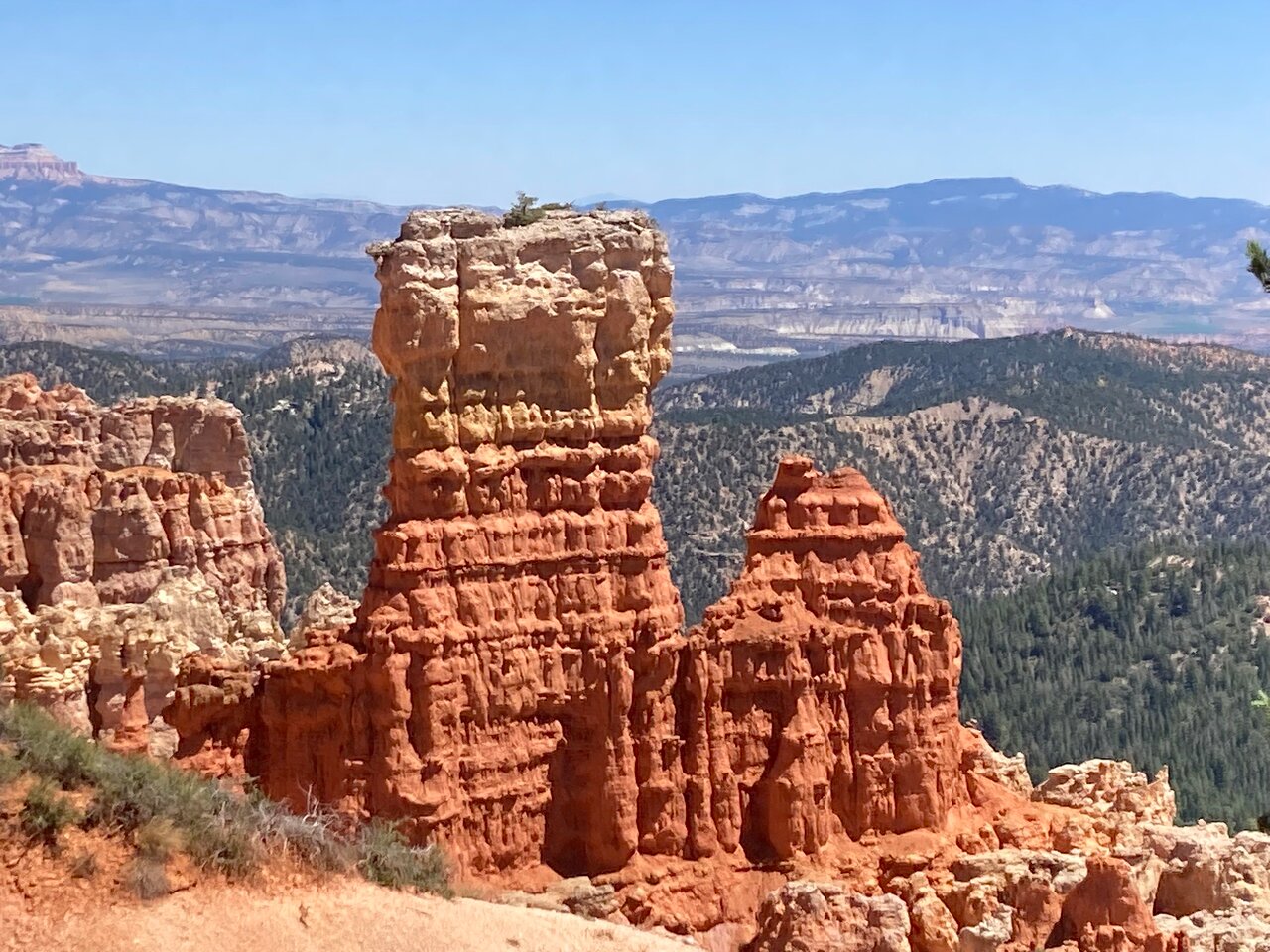
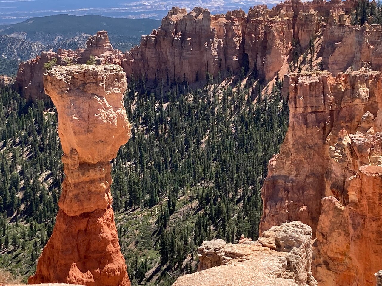
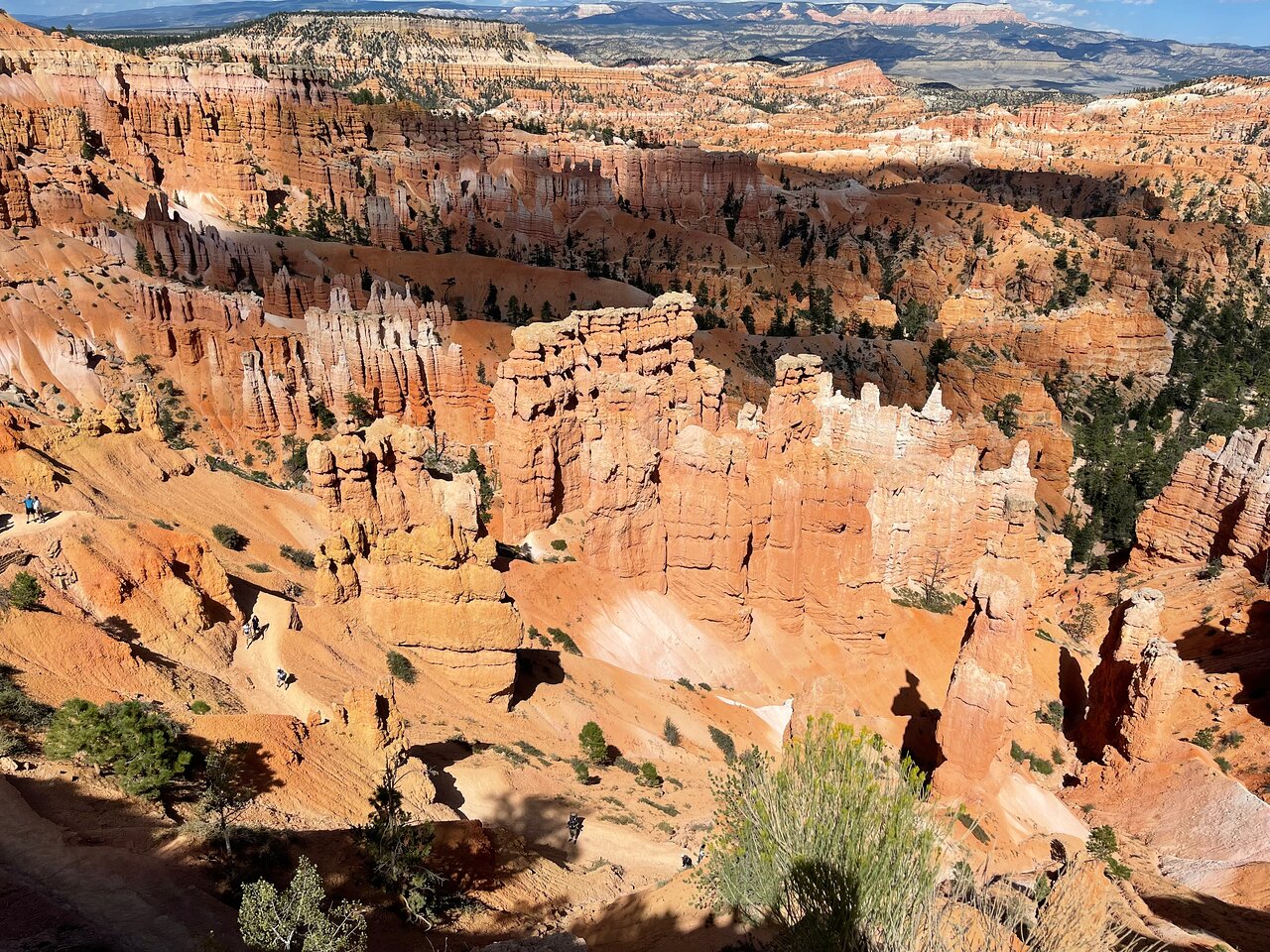
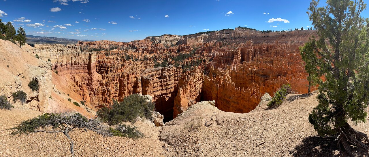
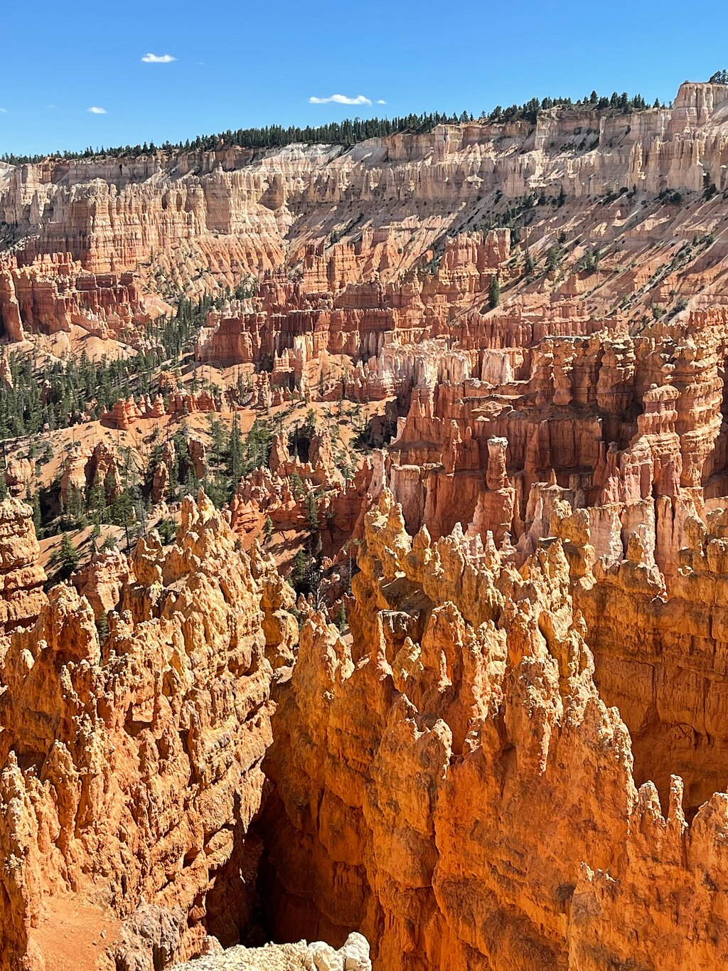
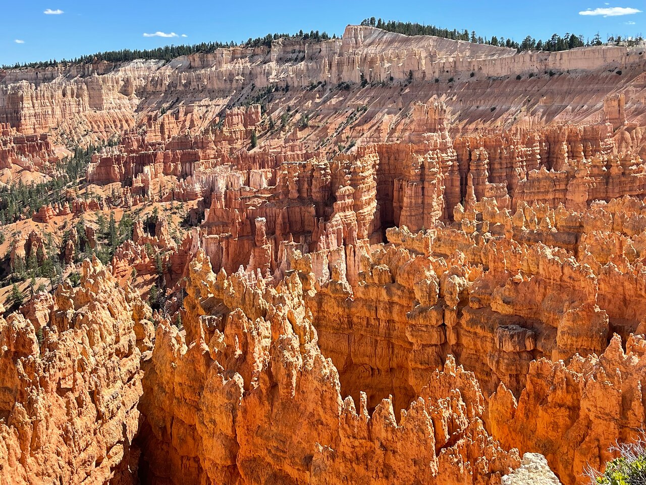
Named after the Mormon Pioneer Ebenezer Bryce, Bryce Canyon became a National Park in 1924. Bryce is famous for its unique geology, which consists of a series of horseshoe-shaped amphitheaters carved from the eastern edge of the Paunsaugunt Plateau in southern Utah. Named after the Mormon Pioneer Ebenezer Bryce, Bryce Canyon became a National Park in 1924. Bryce is famous for its unique geology, which consists of a series of horseshoe-shaped amphitheaters carved from the eastern edge of the Paunsaugunt Plateau in southern Utah. The erosional force has shaped the colorful limestone rock of the Claron Formation into bizarre shapes, including slot canyons, windows, fins, and spires called hoodoos. Tinted with colors too numerous and subtle to name, these whimsically arranged rocks create a wondrous landscape of mazes, offering some of the most exciting and memorable walks and hikes imaginable.
2
Bryce Canyon Visitor Center
Embark on this epic adventure through Bryce Canyon National Park just before the Visitor Center. As we begin the drive, we'll learn about how the canyon got its namesake and about the original Paitue people who called this land home.
3
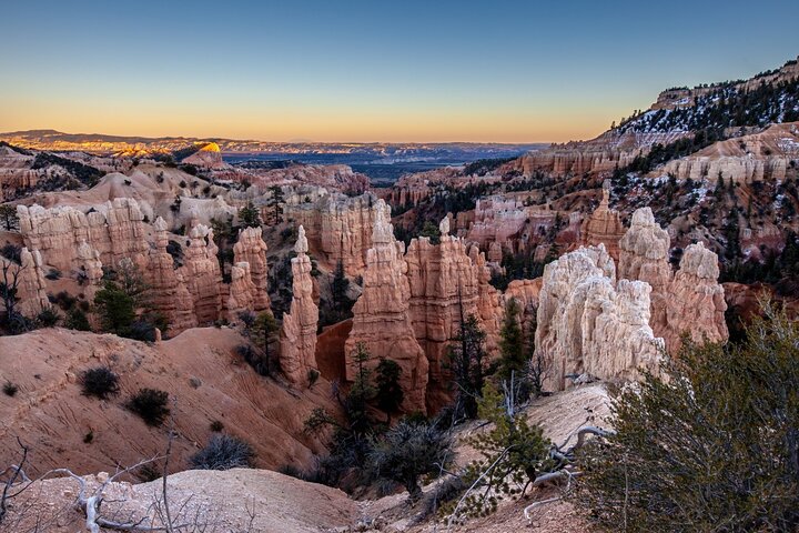
Fairyland Point
Our first detour is at the breathtaking Fairyland Point. This overlook offers a great sneak peek at everything Bryce Canyon contains: sweeping vistas, sheer cliffs, and, of course, the world-famous hoodoos!
4
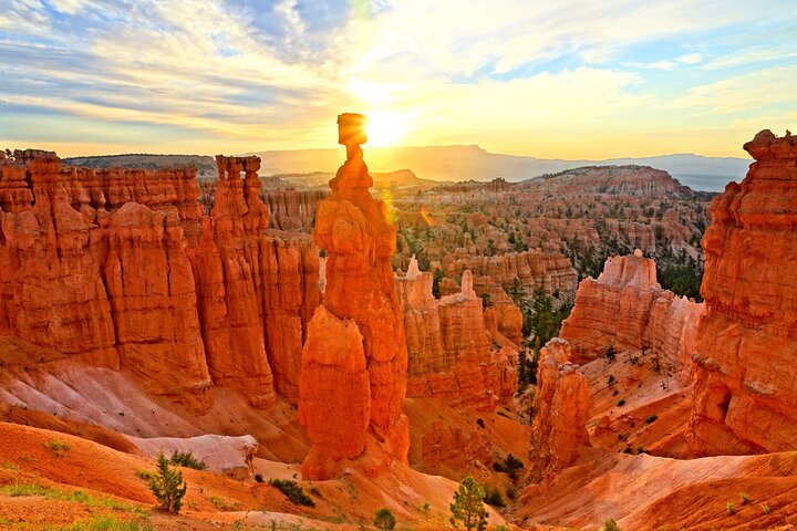
Sunrise Point
Our next stop is one of the most famous in the entire park: Sunrise Point. From this vantage point, we'll see unique, picturesque rock formations spread out in front of us and a plethora of natural trails leading into the vast, alient landscape.
5
Sunset Point
Our drive brings us to another striking vista point overlooking the Bryce Amphitheatre: Sunset Point. Here, as we gaze out over the implausible shapes below us, we'll learn about the science behind their formations and understand what, exactly, makes a hoodoo. We'll explore the impact of geology and erosion over a monumental time scale, hoping to understand how such a incredible landscape came into existence.
6
Inspiration Point
We continue our self-guided tour deeper into Bryce Canyon, towards Inspiration Point. As we drive, we learn about the Paiute people and their mythologies. They had their own explanation for the uniqueness of this landscape and the origins of Bryce's famous hoodoos.
7
Bryce Point
This brings us to Bryce Point, which offers one of the most scenic vistas of the full amphitheater. Bryce Point is also famous for its extraordinary sunrises. From here you can watch the tops of hoodoos set alight as if by fire from the first rays of the rising sun. Like fire, the orange light quickly spreads driving shadows from all but the deepest recesses of the amphitheater. As we drive here, we'll learn about the Mormon settlers who followed the Paitue and tried to eke out a living in this unforgiving climate.
8
Paria View
Our self-guided tour continues to Paria View, where we see the effects of a centuries-old glacier. As the earth warmed about 12,000 years ago, the last ice age came to an end. As the enormous glaciers which covered the American continent melted, all that new water had to go somewhere. Answer: down the canyon!
9
Farview Point
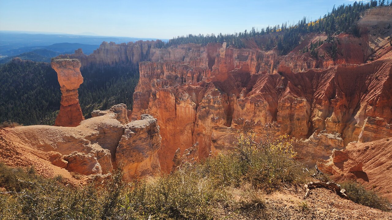
Our next stop is at Farview Point. It’s not just the elevation that allows for such incredible views here -- the land here also offers something becoming increasingly rare in today’s world. Can you guess what it is? Clean air! That's helped along by the abundance of bristlecone pines here, which are the Earth's oldest trees.
10
Agua Canyon
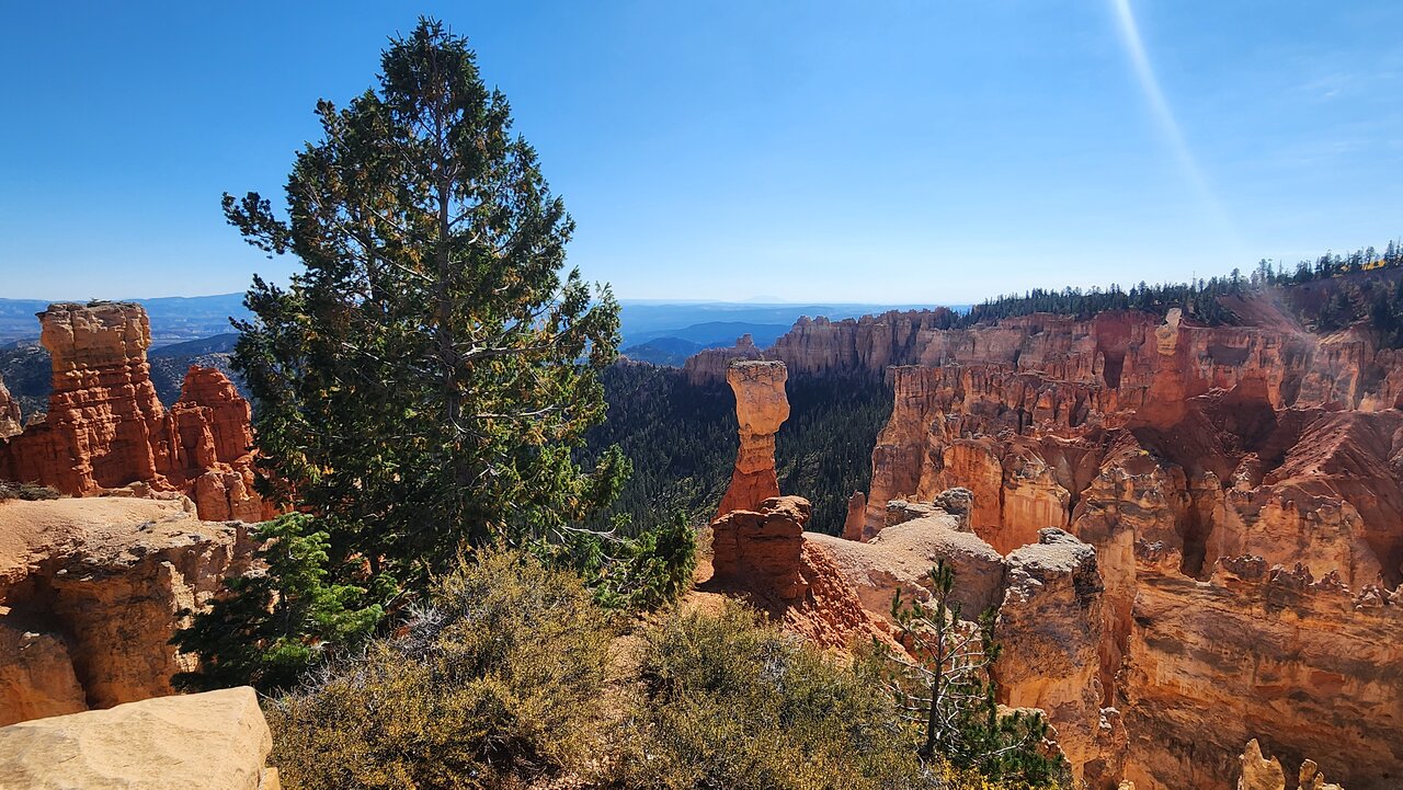
At Agua Canyon two prominent hoodoos command attention. On the left, is the taller of the two towers, "The Hunter." To the right, the "Rabbit". Neither look anything like a hunter or rabbit though! As we drive on, we'll learn about rabbits, deer, and other wildlife of Bryce. We'll also understand what tricks they use to survive the scorching hot summers and deeply freezing winters.
11
Ponderosa Canyon
This brings us to Ponderosa Point, from which you can see the park’s iconic junipers sprawling out into the distance. We're now driving into the deepest recesses of Bryce Canyon National Park.
12
Rainbow Point
Finally, we reach the farthest overlooks inside Bryce Canyon: Rainbow and Yovimpa. From here, you can see nearly everything in Bryce Canyon -- the quintessential hoodoos, the verdant basin, the sheer cliffs. You can even see that you're on the top step of the incredibly massive "Grand Staircase" -- a geologic structure "stepping down" all the way to the Grand Canyon in Arizona.
13
Bryce Canyon National Park
Named after the Mormon Pioneer Ebenezer Bryce, Bryce Canyon became a National Park in 1924. Bryce is famous for its unique geology, which consists of a series of horseshoe-shaped amphitheaters carved from the eastern edge of the Paunsaugunt Plateau in southern Utah. Named after the Mormon Pioneer Ebenezer Bryce, Bryce Canyon became a National Park in 1924. Bryce is famous for its unique geology, which consists of a series of horseshoe-shaped amphitheaters carved from the eastern edge of the Paunsaugunt Plateau in southern Utah. The erosional force has shaped the colorful limestone rock of the Claron Formation into bizarre shapes, including slot canyons, windows, fins, and spires called hoodoos. Tinted with colors too numerous and subtle to name, these whimsically arranged rocks create a wondrous landscape of mazes, offering some of the most exciting and memorable walks and hikes imaginable.
14
Bryce Canyon Visitor Center
Embark on this epic adventure through Bryce Canyon National Park just before the Visitor Center. As we begin the drive, we'll learn about how the canyon got its namesake and about the original Paitue people who called this land home.
15
Fairyland Point
Our first detour is at the breathtaking Fairyland Point. This overlook offers a great sneak peek at everything Bryce Canyon contains: sweeping vistas, sheer cliffs, and, of course, the world-famous hoodoos!
16
Sunrise Point
Our next stop is one of the most famous in the entire park: Sunrise Point. From this vantage point, we'll see unique, picturesque rock formations spread out in front of us and a plethora of natural trails leading into the vast, alient landscape.
17
Sunset Point
Our drive brings us to another striking vista point overlooking the Bryce Amphitheatre: Sunset Point. Here, as we gaze out over the implausible shapes below us, we'll learn about the science behind their formations and understand what, exactly, makes a hoodoo. We'll explore the impact of geology and erosion over a monumental time scale, hoping to understand how such a incredible landscape came into existence.
18
Inspiration Point
We continue our self-guided tour deeper into Bryce Canyon, towards Inspiration Point. As we drive, we learn about the Paiute people and their mythologies. They had their own explanation for the uniqueness of this landscape and the origins of Bryce's famous hoodoos.
19
Bryce Point
This brings us to Bryce Point, which offers one of the most scenic vistas of the full amphitheater. Bryce Point is also famous for its extraordinary sunrises. From here you can watch the tops of hoodoos set alight as if by fire from the first rays of the rising sun. Like fire, the orange light quickly spreads driving shadows from all but the deepest recesses of the amphitheater. As we drive here, we'll learn about the Mormon settlers who followed the Paitue and tried to eke out a living in this unforgiving climate.
20
Paria View
Our self-guided tour continues to Paria View, where we see the effects of a centuries-old glacier. As the earth warmed about 12,000 years ago, the last ice age came to an end. As the enormous glaciers which covered the American continent melted, all that new water had to go somewhere. Answer: down the canyon!
21
Farview Point
Our next stop is at Farview Point. It’s not just the elevation that allows for such incredible views here -- the land here also offers something becoming increasingly rare in today’s world. Can you guess what it is? Clean air! That's helped along by the abundance of bristlecone pines here, which are the Earth's oldest trees.
22
Agua Canyon
At Agua Canyon two prominent hoodoos command attention. On the left, is the taller of the two towers, "The Hunter." To the right, the "Rabbit". Neither look anything like a hunter or rabbit though! As we drive on, we'll learn about rabbits, deer, and other wildlife of Bryce. We'll also understand what tricks they use to survive the scorching hot summers and deeply freezing winters.
23
Ponderosa Canyon
This brings us to Ponderosa Point, from which you can see the park’s iconic junipers sprawling out into the distance. We're now driving into the deepest recesses of Bryce Canyon National Park.
24
Rainbow Point
Finally, we reach the farthest overlooks inside Bryce Canyon: Rainbow and Yovimpa. From here, you can see nearly everything in Bryce Canyon -- the quintessential hoodoos, the verdant basin, the sheer cliffs. You can even see that you're on the top step of the incredibly massive "Grand Staircase" -- a geologic structure "stepping down" all the way to the Grand Canyon in Arizona.
25
Bryce Canyon National Park
Named after the Mormon Pioneer Ebenezer Bryce, Bryce Canyon became a National Park in 1924. Bryce is famous for its unique geology, which consists of a series of horseshoe-shaped amphitheaters carved from the eastern edge of the Paunsaugunt Plateau in southern Utah. Named after the Mormon Pioneer Ebenezer Bryce, Bryce Canyon became a National Park in 1924. Bryce is famous for its unique geology, which consists of a series of horseshoe-shaped amphitheaters carved from the eastern edge of the Paunsaugunt Plateau in southern Utah. The erosional force has shaped the colorful limestone rock of the Claron Formation into bizarre shapes, including slot canyons, windows, fins, and spires called hoodoos. Tinted with colors too numerous and subtle to name, these whimsically arranged rocks create a wondrous landscape of mazes, offering some of the most exciting and memorable walks and hikes imaginable.
26
Bryce Canyon Visitor Center
Embark on this epic adventure through Bryce Canyon National Park just before the Visitor Center. As we begin the drive, we'll learn about how the canyon got its namesake and about the original Paitue people who called this land home.
27
Fairyland Point
Our first detour is at the breathtaking Fairyland Point. This overlook offers a great sneak peek at everything Bryce Canyon contains: sweeping vistas, sheer cliffs, and, of course, the world-famous hoodoos!
28
Sunrise Point
Our next stop is one of the most famous in the entire park: Sunrise Point. From this vantage point, we'll see unique, picturesque rock formations spread out in front of us and a plethora of natural trails leading into the vast, alient landscape.
29
Sunset Point
Our drive brings us to another striking vista point overlooking the Bryce Amphitheatre: Sunset Point. Here, as we gaze out over the implausible shapes below us, we'll learn about the science behind their formations and understand what, exactly, makes a hoodoo. We'll explore the impact of geology and erosion over a monumental time scale, hoping to understand how such a incredible landscape came into existence.
30
Inspiration Point
We continue our self-guided tour deeper into Bryce Canyon, towards Inspiration Point. As we drive, we learn about the Paiute people and their mythologies. They had their own explanation for the uniqueness of this landscape and the origins of Bryce's famous hoodoos.
31
Bryce Point
This brings us to Bryce Point, which offers one of the most scenic vistas of the full amphitheater. Bryce Point is also famous for its extraordinary sunrises. From here you can watch the tops of hoodoos set alight as if by fire from the first rays of the rising sun. Like fire, the orange light quickly spreads driving shadows from all but the deepest recesses of the amphitheater. As we drive here, we'll learn about the Mormon settlers who followed the Paitue and tried to eke out a living in this unforgiving climate.
32
Paria View
Our self-guided tour continues to Paria View, where we see the effects of a centuries-old glacier. As the earth warmed about 12,000 years ago, the last ice age came to an end. As the enormous glaciers which covered the American continent melted, all that new water had to go somewhere. Answer: down the canyon!
33
Farview Point
Our next stop is at Farview Point. It’s not just the elevation that allows for such incredible views here -- the land here also offers something becoming increasingly rare in today’s world. Can you guess what it is? Clean air! That's helped along by the abundance of bristlecone pines here, which are the Earth's oldest trees.
34
Agua Canyon
At Agua Canyon two prominent hoodoos command attention. On the left, is the taller of the two towers, "The Hunter." To the right, the "Rabbit". Neither look anything like a hunter or rabbit though! As we drive on, we'll learn about rabbits, deer, and other wildlife of Bryce. We'll also understand what tricks they use to survive the scorching hot summers and deeply freezing winters.
35
Ponderosa Canyon
This brings us to Ponderosa Point, from which you can see the park’s iconic junipers sprawling out into the distance. We're now driving into the deepest recesses of Bryce Canyon National Park.
36
Rainbow Point
Finally, we reach the farthest overlooks inside Bryce Canyon: Rainbow and Yovimpa. From here, you can see nearly everything in Bryce Canyon -- the quintessential hoodoos, the verdant basin, the sheer cliffs. You can even see that you're on the top step of the incredibly massive "Grand Staircase" -- a geologic structure "stepping down" all the way to the Grand Canyon in Arizona.
37
Bryce Canyon National Park
Named after the Mormon Pioneer Ebenezer Bryce, Bryce Canyon became a National Park in 1924. Bryce is famous for its unique geology, which consists of a series of horseshoe-shaped amphitheaters carved from the eastern edge of the Paunsaugunt Plateau in southern Utah. Named after the Mormon Pioneer Ebenezer Bryce, Bryce Canyon became a National Park in 1924. Bryce is famous for its unique geology, which consists of a series of horseshoe-shaped amphitheaters carved from the eastern edge of the Paunsaugunt Plateau in southern Utah. The erosional force has shaped the colorful limestone rock of the Claron Formation into bizarre shapes, including slot canyons, windows, fins, and spires called hoodoos. Tinted with colors too numerous and subtle to name, these whimsically arranged rocks create a wondrous landscape of mazes, offering some of the most exciting and memorable walks and hikes imaginable.
38
Bryce Canyon Visitor Center
Embark on this epic adventure through Bryce Canyon National Park just before the Visitor Center. As we begin the drive, we'll learn about how the canyon got its namesake and about the original Paitue people who called this land home.
39
Fairyland Point
Our first detour is at the breathtaking Fairyland Point. This overlook offers a great sneak peek at everything Bryce Canyon contains: sweeping vistas, sheer cliffs, and, of course, the world-famous hoodoos!
40
Sunrise Point
Our next stop is one of the most famous in the entire park: Sunrise Point. From this vantage point, we'll see unique, picturesque rock formations spread out in front of us and a plethora of natural trails leading into the vast, alient landscape.
41
Sunset Point
Our drive brings us to another striking vista point overlooking the Bryce Amphitheatre: Sunset Point. Here, as we gaze out over the implausible shapes below us, we'll learn about the science behind their formations and understand what, exactly, makes a hoodoo. We'll explore the impact of geology and erosion over a monumental time scale, hoping to understand how such a incredible landscape came into existence.
42
Inspiration Point
We continue our self-guided tour deeper into Bryce Canyon, towards Inspiration Point. As we drive, we learn about the Paiute people and their mythologies. They had their own explanation for the uniqueness of this landscape and the origins of Bryce's famous hoodoos.
43
Bryce Point
This brings us to Bryce Point, which offers one of the most scenic vistas of the full amphitheater. Bryce Point is also famous for its extraordinary sunrises. From here you can watch the tops of hoodoos set alight as if by fire from the first rays of the rising sun. Like fire, the orange light quickly spreads driving shadows from all but the deepest recesses of the amphitheater. As we drive here, we'll learn about the Mormon settlers who followed the Paitue and tried to eke out a living in this unforgiving climate.
44
Paria View
Our self-guided tour continues to Paria View, where we see the effects of a centuries-old glacier. As the earth warmed about 12,000 years ago, the last ice age came to an end. As the enormous glaciers which covered the American continent melted, all that new water had to go somewhere. Answer: down the canyon!
45
Farview Point
Our next stop is at Farview Point. It’s not just the elevation that allows for such incredible views here -- the land here also offers something becoming increasingly rare in today’s world. Can you guess what it is? Clean air! That's helped along by the abundance of bristlecone pines here, which are the Earth's oldest trees.
46
Agua Canyon
At Agua Canyon two prominent hoodoos command attention. On the left, is the taller of the two towers, "The Hunter." To the right, the "Rabbit". Neither look anything like a hunter or rabbit though! As we drive on, we'll learn about rabbits, deer, and other wildlife of Bryce. We'll also understand what tricks they use to survive the scorching hot summers and deeply freezing winters.
47
Ponderosa Canyon
This brings us to Ponderosa Point, from which you can see the park’s iconic junipers sprawling out into the distance. We're now driving into the deepest recesses of Bryce Canyon National Park.
48
Rainbow Point
Finally, we reach the farthest overlooks inside Bryce Canyon: Rainbow and Yovimpa. From here, you can see nearly everything in Bryce Canyon -- the quintessential hoodoos, the verdant basin, the sheer cliffs. You can even see that you're on the top step of the incredibly massive "Grand Staircase" -- a geologic structure "stepping down" all the way to the Grand Canyon in Arizona.
49
Bryce Canyon National Park
Named after the Mormon Pioneer Ebenezer Bryce, Bryce Canyon became a National Park in 1924. Bryce is famous for its unique geology, which consists of a series of horseshoe-shaped amphitheaters carved from the eastern edge of the Paunsaugunt Plateau in southern Utah. Named after the Mormon Pioneer Ebenezer Bryce, Bryce Canyon became a National Park in 1924. Bryce is famous for its unique geology, which consists of a series of horseshoe-shaped amphitheaters carved from the eastern edge of the Paunsaugunt Plateau in southern Utah. The erosional force has shaped the colorful limestone rock of the Claron Formation into bizarre shapes, including slot canyons, windows, fins, and spires called hoodoos. Tinted with colors too numerous and subtle to name, these whimsically arranged rocks create a wondrous landscape of mazes, offering some of the most exciting and memorable walks and hikes imaginable.
50
Bryce Canyon Visitor Center
Embark on this epic adventure through Bryce Canyon National Park just before the Visitor Center. As we begin the drive, we'll learn about how the canyon got its namesake and about the original Paitue people who called this land home.
51
Fairyland Point
Our first detour is at the breathtaking Fairyland Point. This overlook offers a great sneak peek at everything Bryce Canyon contains: sweeping vistas, sheer cliffs, and, of course, the world-famous hoodoos!
52
Sunrise Point
Our next stop is one of the most famous in the entire park: Sunrise Point. From this vantage point, we'll see unique, picturesque rock formations spread out in front of us and a plethora of natural trails leading into the vast, alient landscape.
53
Sunset Point
Our drive brings us to another striking vista point overlooking the Bryce Amphitheatre: Sunset Point. Here, as we gaze out over the implausible shapes below us, we'll learn about the science behind their formations and understand what, exactly, makes a hoodoo. We'll explore the impact of geology and erosion over a monumental time scale, hoping to understand how such a incredible landscape came into existence.
54
Inspiration Point
We continue our self-guided tour deeper into Bryce Canyon, towards Inspiration Point. As we drive, we learn about the Paiute people and their mythologies. They had their own explanation for the uniqueness of this landscape and the origins of Bryce's famous hoodoos.
55
Bryce Point
This brings us to Bryce Point, which offers one of the most scenic vistas of the full amphitheater. Bryce Point is also famous for its extraordinary sunrises. From here you can watch the tops of hoodoos set alight as if by fire from the first rays of the rising sun. Like fire, the orange light quickly spreads driving shadows from all but the deepest recesses of the amphitheater. As we drive here, we'll learn about the Mormon settlers who followed the Paitue and tried to eke out a living in this unforgiving climate.
56
Paria View
Our self-guided tour continues to Paria View, where we see the effects of a centuries-old glacier. As the earth warmed about 12,000 years ago, the last ice age came to an end. As the enormous glaciers which covered the American continent melted, all that new water had to go somewhere. Answer: down the canyon!
57
Farview Point
Our next stop is at Farview Point. It’s not just the elevation that allows for such incredible views here -- the land here also offers something becoming increasingly rare in today’s world. Can you guess what it is? Clean air! That's helped along by the abundance of bristlecone pines here, which are the Earth's oldest trees.
58
Agua Canyon
At Agua Canyon two prominent hoodoos command attention. On the left, is the taller of the two towers, "The Hunter." To the right, the "Rabbit". Neither look anything like a hunter or rabbit though! As we drive on, we'll learn about rabbits, deer, and other wildlife of Bryce. We'll also understand what tricks they use to survive the scorching hot summers and deeply freezing winters.
59
Ponderosa Canyon
This brings us to Ponderosa Point, from which you can see the park’s iconic junipers sprawling out into the distance. We're now driving into the deepest recesses of Bryce Canyon National Park.
60
Rainbow Point
Finally, we reach the farthest overlooks inside Bryce Canyon: Rainbow and Yovimpa. From here, you can see nearly everything in Bryce Canyon -- the quintessential hoodoos, the verdant basin, the sheer cliffs. You can even see that you're on the top step of the incredibly massive "Grand Staircase" -- a geologic structure "stepping down" all the way to the Grand Canyon in Arizona.
61
Bryce Canyon National Park
Named after the Mormon Pioneer Ebenezer Bryce, Bryce Canyon became a National Park in 1924. Bryce is famous for its unique geology, which consists of a series of horseshoe-shaped amphitheaters carved from the eastern edge of the Paunsaugunt Plateau in southern Utah. Named after the Mormon Pioneer Ebenezer Bryce, Bryce Canyon became a National Park in 1924. Bryce is famous for its unique geology, which consists of a series of horseshoe-shaped amphitheaters carved from the eastern edge of the Paunsaugunt Plateau in southern Utah. The erosional force has shaped the colorful limestone rock of the Claron Formation into bizarre shapes, including slot canyons, windows, fins, and spires called hoodoos. Tinted with colors too numerous and subtle to name, these whimsically arranged rocks create a wondrous landscape of mazes, offering some of the most exciting and memorable walks and hikes imaginable.
62
Bryce Canyon Visitor Center
Embark on this epic adventure through Bryce Canyon National Park just before the Visitor Center. As we begin the drive, we'll learn about how the canyon got its namesake and about the original Paitue people who called this land home.
63
Fairyland Point
Our first detour is at the breathtaking Fairyland Point. This overlook offers a great sneak peek at everything Bryce Canyon contains: sweeping vistas, sheer cliffs, and, of course, the world-famous hoodoos!
64
Sunrise Point
Our next stop is one of the most famous in the entire park: Sunrise Point. From this vantage point, we'll see unique, picturesque rock formations spread out in front of us and a plethora of natural trails leading into the vast, alient landscape.
65
Sunset Point
Our drive brings us to another striking vista point overlooking the Bryce Amphitheatre: Sunset Point. Here, as we gaze out over the implausible shapes below us, we'll learn about the science behind their formations and understand what, exactly, makes a hoodoo. We'll explore the impact of geology and erosion over a monumental time scale, hoping to understand how such a incredible landscape came into existence.
66
Inspiration Point
We continue our self-guided tour deeper into Bryce Canyon, towards Inspiration Point. As we drive, we learn about the Paiute people and their mythologies. They had their own explanation for the uniqueness of this landscape and the origins of Bryce's famous hoodoos.
67
Bryce Point
This brings us to Bryce Point, which offers one of the most scenic vistas of the full amphitheater. Bryce Point is also famous for its extraordinary sunrises. From here you can watch the tops of hoodoos set alight as if by fire from the first rays of the rising sun. Like fire, the orange light quickly spreads driving shadows from all but the deepest recesses of the amphitheater. As we drive here, we'll learn about the Mormon settlers who followed the Paitue and tried to eke out a living in this unforgiving climate.
68
Paria View
Our self-guided tour continues to Paria View, where we see the effects of a centuries-old glacier. As the earth warmed about 12,000 years ago, the last ice age came to an end. As the enormous glaciers which covered the American continent melted, all that new water had to go somewhere. Answer: down the canyon!
69
Farview Point
Our next stop is at Farview Point. It’s not just the elevation that allows for such incredible views here -- the land here also offers something becoming increasingly rare in today’s world. Can you guess what it is? Clean air! That's helped along by the abundance of bristlecone pines here, which are the Earth's oldest trees.
70
Agua Canyon
At Agua Canyon two prominent hoodoos command attention. On the left, is the taller of the two towers, "The Hunter." To the right, the "Rabbit". Neither look anything like a hunter or rabbit though! As we drive on, we'll learn about rabbits, deer, and other wildlife of Bryce. We'll also understand what tricks they use to survive the scorching hot summers and deeply freezing winters.
71
Ponderosa Canyon
This brings us to Ponderosa Point, from which you can see the park’s iconic junipers sprawling out into the distance. We're now driving into the deepest recesses of Bryce Canyon National Park.
72
Rainbow Point
Finally, we reach the farthest overlooks inside Bryce Canyon: Rainbow and Yovimpa. From here, you can see nearly everything in Bryce Canyon -- the quintessential hoodoos, the verdant basin, the sheer cliffs. You can even see that you're on the top step of the incredibly massive "Grand Staircase" -- a geologic structure "stepping down" all the way to the Grand Canyon in Arizona.
73
Национальный парк Брайс-Каньон
Названный в честь мормонского пионера Эбенезера Брайса, Брайс-Каньон стал национальным парком в 1924 году. Брайс известен своей уникальной геологией, состоящей из ряда подковообразных амфитеатров, вырезанных на восточной окраине плато Паунсаугант в южной части штата Юта. Названный в честь мормонского пионера Эбенезера Брайса, Брайс-Каньон стал национальным парком в 1924 году. Брайс известен своей уникальной геологией, состоящей из ряда подковообразных амфитеатров, вырезанных на восточной окраине плато Паунсаугант в южной части штата Юта. Сила эрозии придала красочной известняковой скале формации Кларон причудливые формы, в том числе щелевые каньоны, окна, плавники и шпили, называемые худу. Эти причудливо расположенные скалы, окрашенные в слишком многочисленные и тонкие цвета, создают удивительный ландшафт лабиринтов, предлагая одни из самых захватывающих и запоминающихся прогулок и походов, которые только можно себе представить.
74
Туристический центр Брайс-Каньона
Отправляйтесь в это эпическое приключение по национальному парку Брайс-Каньон прямо перед центром для посетителей. Когда мы начнем поездку, мы узнаем о том, как каньон получил свое имя, и о коренных народах пайту, которые называли эту землю своим домом.
75
Фейриленд Пойнт
Наш первый крюк находится в захватывающей дух Fairyland Point. С этой точки зрения открывается прекрасный вид на все, что есть в Брайс-Каньоне: широкие перспективы, отвесные скалы и, конечно же, всемирно известные худу!
76
Восход Точка
Наша следующая остановка — одна из самых известных во всем парке: Sunrise Point. С этой точки зрения мы увидим уникальные, живописные скальные образования, раскинувшиеся перед нами, и множество естественных троп, ведущих в обширный инопланетный ландшафт.
77
Сансет Точка
Наша поездка приводит нас к еще одной поразительной точке обзора с видом на амфитеатр Брайса: Сансет-Пойнт. Здесь, глядя на неправдоподобные формы под нами, мы узнаем о науке, стоящей за их образованием, и поймем, что именно создает худу. Мы изучим влияние геологии и эрозии в монументальном временном масштабе, надеясь понять, как появился такой невероятный ландшафт.
78
Точка вдохновения
Мы продолжаем нашу самостоятельную экскурсию вглубь Брайс-Каньона, к точке Вдохновения. Пока мы едем, мы узнаем о народе пайютов и их мифологии. У них было собственное объяснение уникальности этого ландшафта и происхождения знаменитых худу Брайса.
79
Брайс Пойнт
Это приводит нас к Брайс-Пойнт, откуда открывается один из самых живописных видов на весь амфитеатр. Брайс-Пойнт также известен своими необычными восходами солнца. Отсюда можно наблюдать, как верхушки худу загораются, словно от первых лучей восходящего солнца. Подобно огню, оранжевый свет быстро отбрасывает движущиеся тени из всех уголков амфитеатра, кроме самых глубоких. Пока мы едем сюда, мы узнаем о поселенцах-мормонах, которые следовали за пайту и пытались зарабатывать на жизнь в этом неумолимом климате.
80
Пария Вью
Наша самостоятельная экскурсия продолжается в Париа Вью, где мы видим последствия многовекового ледника. Когда земля прогрелась около 12 000 лет назад, последний ледниковый период подошел к концу. По мере таяния огромных ледников, покрывавших американский континент, вся эта новая вода должна была куда-то уходить. Ответ: вниз по каньону!
81
Фарвью-Пойнт
Наша следующая остановка — Фарвью-Пойнт. Здесь не только высота дает такие невероятные виды — земля здесь также предлагает что-то, что становится все более редким в современном мире. Сможете угадать, что это? Чистый воздух! Этому способствует обилие здесь щетинистых сосен, которые являются старейшими деревьями на Земле.
82
Каньон Агуа
В каньоне Агуа внимание привлекают два известных худу. Слева находится более высокая из двух башен «Охотник». Справа «Кролик». Ни то, ни другое не похоже на охотника или кролика! По дороге мы узнаем о кроликах, оленях и других диких животных Брайса. Мы также поймем, какие уловки они используют, чтобы пережить палящее жаркое лето и морозную зиму.
83
Каньон Пондероза
Это приводит нас к Пондероза-Пойнт, откуда вы можете увидеть культовые можжевельники парка, простирающиеся вдаль. Теперь мы въезжаем в самые глубокие уголки национального парка Брайс-Каньон.
84
Рейнбоу Пойнт
Наконец, мы достигаем самых дальних видов внутри Брайс-Каньона: Рэйнбоу и Йовимпа. Отсюда вы можете увидеть почти все в Брайс-Каньоне - квинтэссенцию худу, зеленую котловину, отвесные скалы. Вы даже можете увидеть, что вы находитесь на верхней ступеньке невероятно массивной «Большой лестницы» — геологической структуры, «спускающейся вниз» вплоть до Гранд-Каньона в Аризоне.
Показать 81 больше остановок
Политика отмены
Чтобы получить полный возврат средств, отмените бронирование как минимум за 24 часа до запланированного времени вылета.
Фотографии путешественников
Отзывы (18)
Wendy_H
Nov 2022
Easy to use and informative. Easy to download. Don’t need cell service. Used for other parks and very happy with app.
Ответ от хоста
Nov 2022
Thank you so much for your feedback, Wendy! I’m delighted that my tour of Bryce added to your learning and that you enjoyed it. I also have 100 other self-guided tours for other parks, scenic drives, cities, and historic sites in the US — hopefully, you’ll get the chance to try them next time! Also, just to remind you, the tour you bought is yours for a lifetime. So, you can listen to it at home or on your next visit.
Robert H
Nov 2022
This was a great audio tour with tons of useful information and matched up perfectly with the GPS. The ease of use was a huge plus and I would not hesitate to purchase this tour again for another National Park.
Ответ от хоста
Nov 2022
Thank you so much for your feedback, Robert! I’m delighted that my tour of Bryce added to your learning and that you enjoyed it. I also have 100 other self-guided tours for other parks, scenic drives, cities, and historic sites in the US — hopefully, you’ll get the chance to try them next time! Also, just to remind you, the tour you bought is yours for a lifetime. So, you can listen to it at home or on your next visit.
952BobL952
Oct 2022
Starting point was the wrong direction from the park. Gps should have caught that. Drove 20 miles in the wrong way. Tour navigation was ambiguous. Also it snowed so half of the sites on the tour were closed. Wound up taking the shuttle and visiting a couple of accessible sites. Trail guides were useful.
Ответ от хоста
Nov 2022
The program is designed to work in Bryce and any other park with limited internet access. I never changed its starting point. I recommend that everyone use their GPS to go to the starting point, where the app will begin automatically. In any case, I would gladly switch the tour for any of my other 100 tours in the United States. Please notify me. This tour is yours to keep for the rest of your life. It may be used for photos, a second evaluation at home, sharing with friends, and planning your future vacation here.

Связанные события

События в том же районе

Мы думаем, что ваш язык English
На каком языке вы хотели бы видеть эту страницу?
English English
Мы думаем, что ваш город Нью-Йорк
В каком городе вы бы хотели исследовать?
Нью-Йорк
New York City