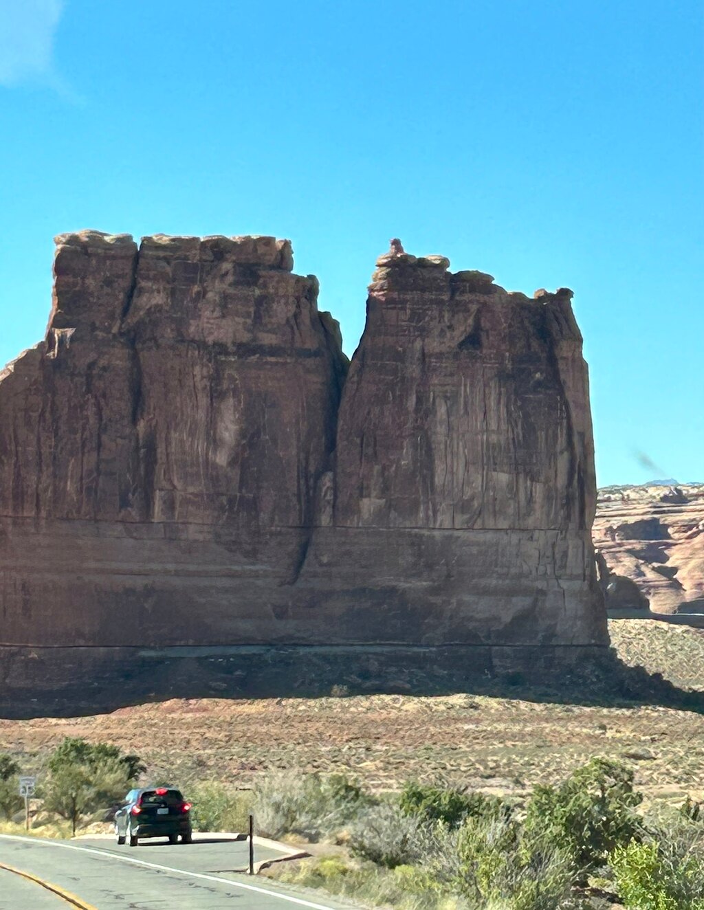
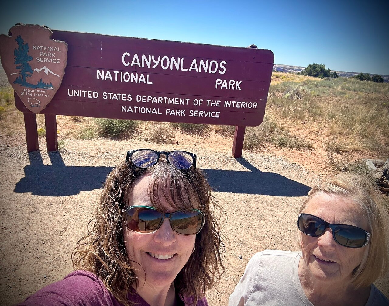
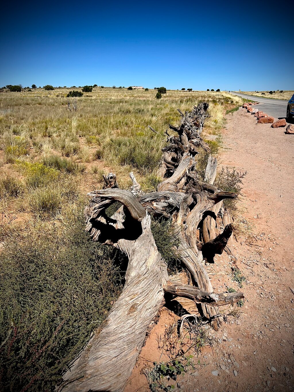
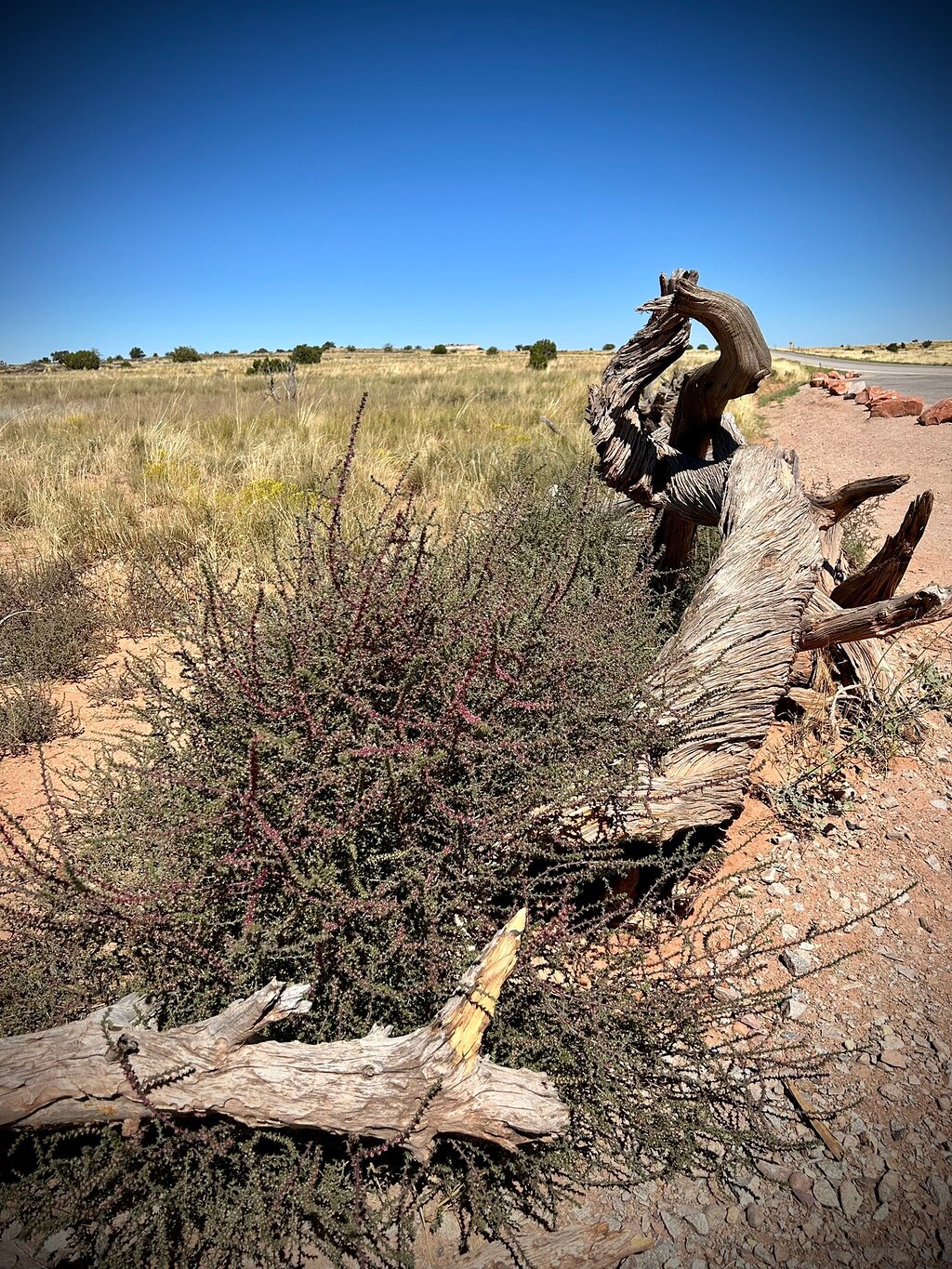
Ничего не найдено
Исследовать
Log in

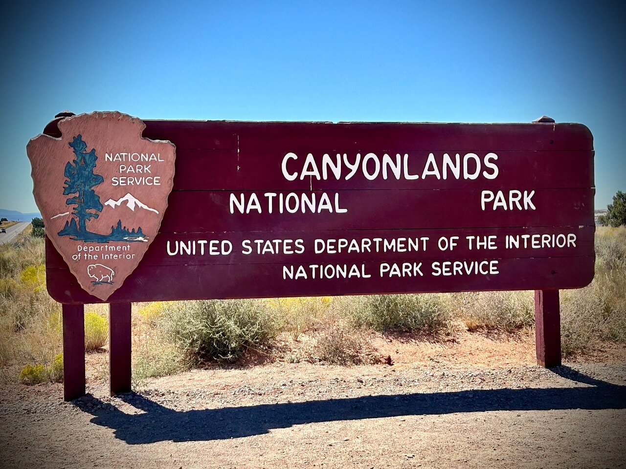
Самостоятельный тур по национальному парку Каньонлендс

Обзор
Recommended: Purchase one tour per car, not per person. Everyone listens together!

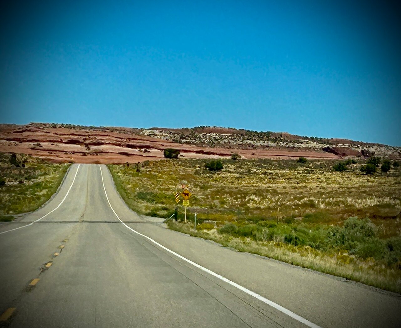
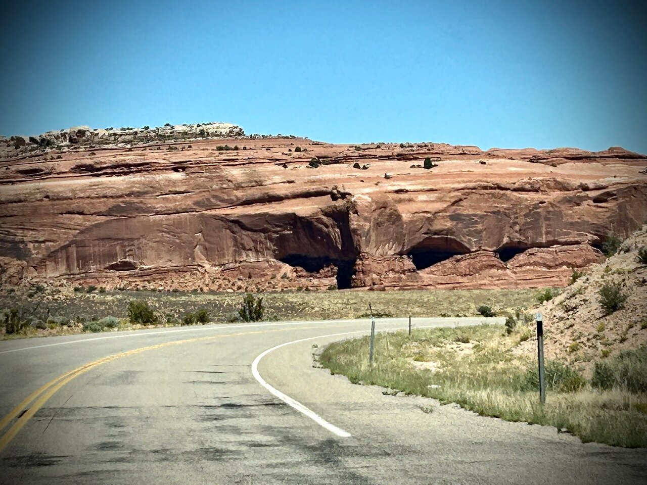
Explore the sweeping canyons, deep valleys, and gigantic mesas of Canyonlands National Park with this self-guided driving tour. Discover Mesa Arch and its iconic sunrise, admire a stunning landscape from the White Rim Trail, and learn about the cowboys who once tried to tame this wild and wonderful land. This self-guided tour allows you to explore Canyonlands with maximum flexibility and value.

After booking, check your email to download the separate Audio Tour Guide App by Action, enter your unique password, and access your tour. These steps require good internet/Wi-Fi access. From there, follow the audio instructions and the route.

Buy once, use for one year! Ideal for extended visits and return trips over the next 12 months.

This isn't an entrance ticket. Check opening hours before your visit.
Город: Моав
Thu 17 Jul
i
Выбрать дату можно уже на сайте бронирования
Начинается с $16.99
Thu 17 Jul
Начинается с $16.99
Зарезервировать
Что включено
Offline use: No cell signal or wifi required. Offline GPS Map & route. Stop-to-stop direction.
Private tour in your/rental car: No group. Take breaks for photos/ snacks/hikes. Go at your own pace
Don’t miss a thing: Full itinerary, travel tips, professionally narrated hidden stories, video, text
Flexible schedule: Use any day, any time. Travel over multiple days or on next trip. Never expires.
Good value: Buy just one per car. Don’t pay for each person. Save money compared to a bus tour.
App on your phone: A link to download the Action Guide app. Password for your tours. Preview at home
Easy to use: Stories play automatically by GPS. Hands-free. Get HELP all day: Call, Chat or Email.
Дополнительная информация
  • Public transportation options are available nearby
  • Suitable for all physical fitness levels
  • How to access: Once you book a tour, you’ll get a confirmation email and text with instructions: • Download the separate tour app by Action • Enter the password • Download the tour MUST DO while in strong wifi/cellular Works offline after download
  • How to start touring: Open Action’s separate audio tour guide app once onsite. • If there is just one tour, launch it. • If multiple tour versions exist, launch the one with your planned starting point and direction.
  • Go to the starting point No one will meet you at the start. This tour is self-guided Enter the first story’s point and the audio will begin automatically Follow the audio cues to the next story, which will also play automatically. Enjoy hands-free exploring. If you face audio issues, contact support. Stick to the tour route & speed limit for the best experience.
  • Travel worry-free: Use the tour app anytime, on any day, and over multiple days. Start and pause the tour whenever you like, taking breaks and exploring side excursions at your own pace. Skip anything you don’t care about or explore bonus content for everything that interests you
  • Savings tips: Driving tours: purchase just one tour for everyone in the car
  • Buy once, use for one year! Ideal for extended visits and return trips over the next 12 months.
Что ожидать
1
Canyonlands National Park
Canyonlands National Park in southeastern Utah is known for its dramatic desert landscape carved by the Colorado River. Island in the Sky is a huge, flat-topped mesa with panoramic overlooks. Other notable areas include the towering rock pinnacles known as the Needles, the remote canyons of the Maze, and the Native American rock paintings in Horseshoe Canyon. Whitewater rapids flow through Cataract Canyon.
2
Cataract Canyon
Cataract Canyon is a 46-mile-long canyon of the Colorado River located within Canyonlands National Park and Glen Canyon National Recreation Area in southern Utah.
3
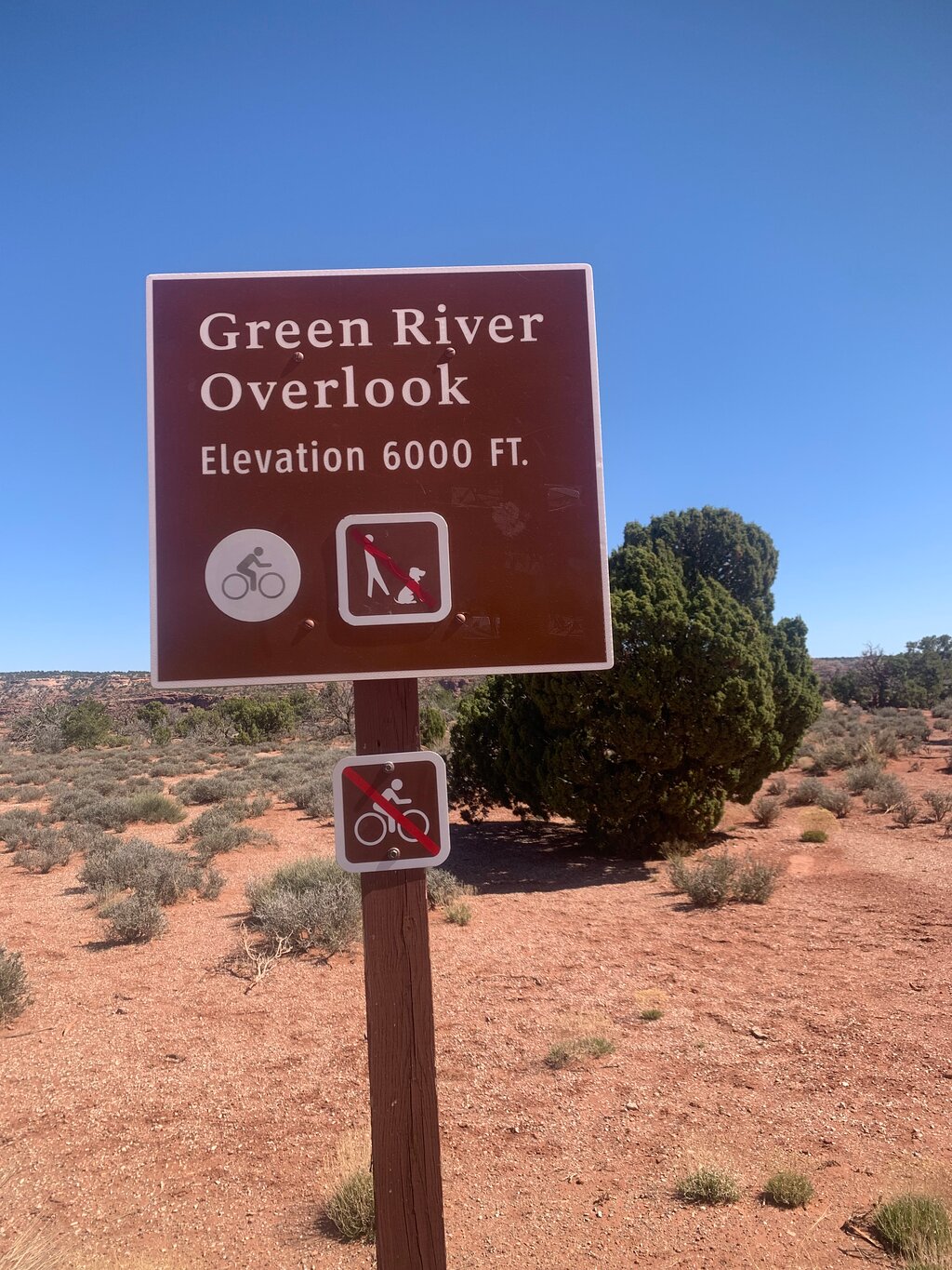
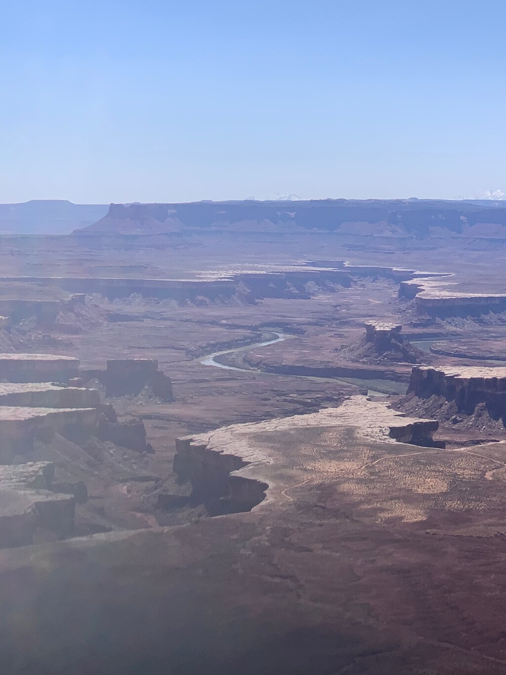
Green River Overlook
The Green River Overlook offers some of the most unique views of Canyonland’s Island in the Sky District. You’re able to see the Green River continuing its work on the canyon walls. The river is the largest stream in Utah at 730 miles. The name probably comes from the green soapstone that can be found along its banks.
4
Island In The Sky Visitor Center
Stop by the Visitor Center coming up ahead. It’s a great place to grab supplies, use the bathroom, and fill up your water bottles. As you’ve already seen, this park doesn’t have much infrastructure, and being dehydrated out here is no joke.
5
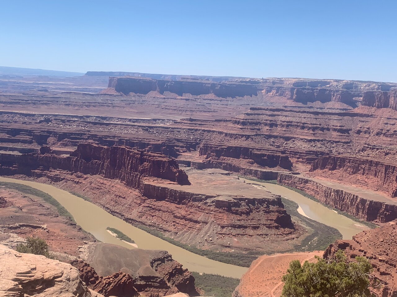
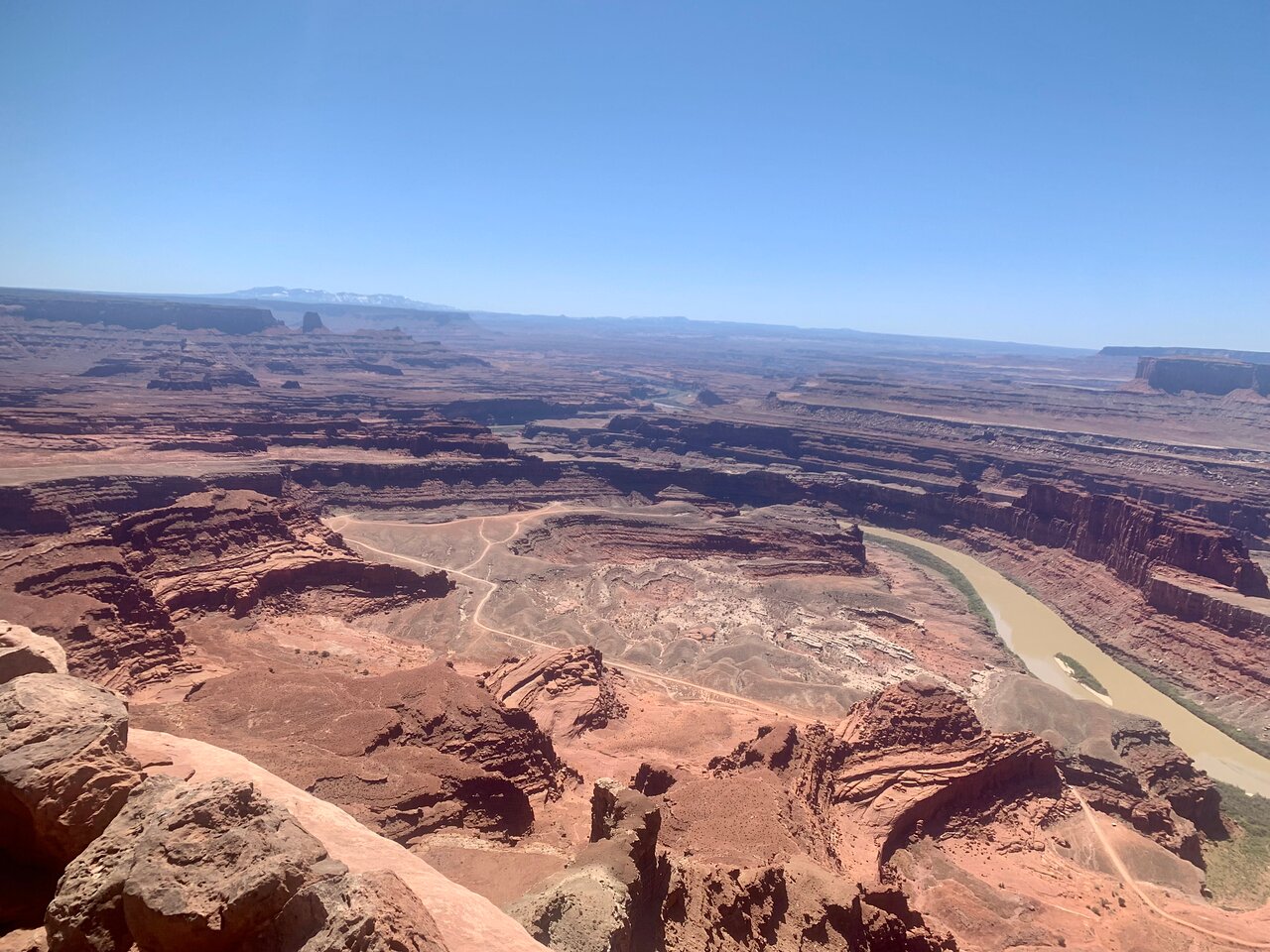
Dead Horse Point State Park
Dead Horse Point — it’s a creepy name, isn’t it? According to local legend, wild mustangs used to be corralled here to be broken in the early 1800s. Once all the desirable horses had been broken and claimed by the cowboys, the undesirables were left to go free.
6
Corona Arch
Corona Arch is a natural sandstone arch near Moab. The arch is located within the same rock formation as Pinto Arch and Bowtie Arch.
7
Shafer Canyon Overlook
This overlook offers views from three sides. It may be a bit daunting if you're afraid of heights since there’s nothing between you and the Canyon. However, the incredible view is worth it.
8
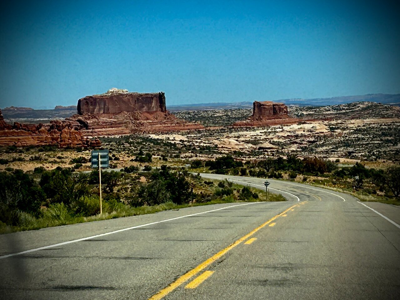
Monitor and Merriamac Rock Formations
Look to the right. All you can see at the moment are tall rock walls. That’s because we’re near the floor of Sevenmile Canyon. As we continue to drive, we’ll emerge from the canyon and be able to see two very distinct features in the distance to the right -- the Merrimac and the Monitor.
9
Lathrop Canyon
A lot of natural landmarks and trails in Canyonlands are named by or after cowboys and ranchers. In fact, Ned Chaffin’s father and one of his brothers had a spring named after them.
10
Aztec Butte Trail
What makes this trail special? Simple: the granaries left here by Native peoples. They’re visible from the base of the last hill if you just keep your eyes open. These granaries are hundreds of years old, so be careful when approaching.
11
Whale Rock
In front of you is perhaps the world’s largest whale. Don’t see it? The whale’s head is on the left side of the rock. There’s an easy one-mile hike that takes you up along the whale’s back. When you get on top of this cetacean, you’ll be rewarded with spectacular views of the Upheaval Dome.
12
Mesa Arch
Ahead, pull over for Mesa Arch. This is a must-do at Canyonlands. Once you’ve parked, walk along the short trail to the arch. As you walk, notice the juniper and pinyon trees around you. These are popular in Canyonlands so keep an eye out for them elsewhere too.
13
Candlestick Tower Overlook
In the distance, do you see three giant candles sticking out of the landscape? That’s Candlestick Tower! Doesn’t this sandstone formation look like a layered birthday cake, topped with candles? * The bottom layer is white, the middle a reddish-brown, and the top is red.
14
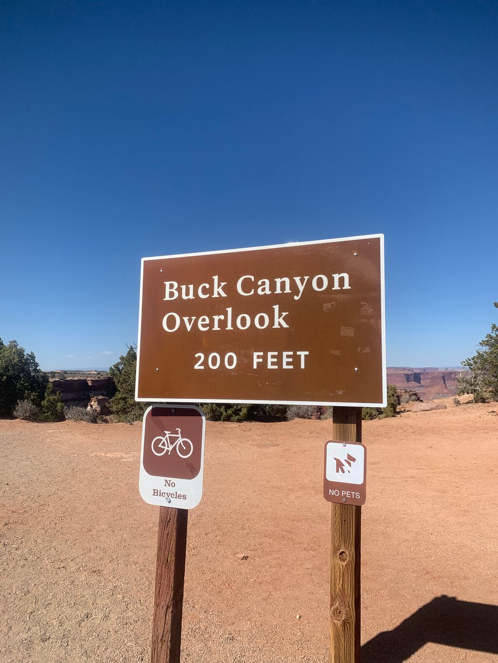
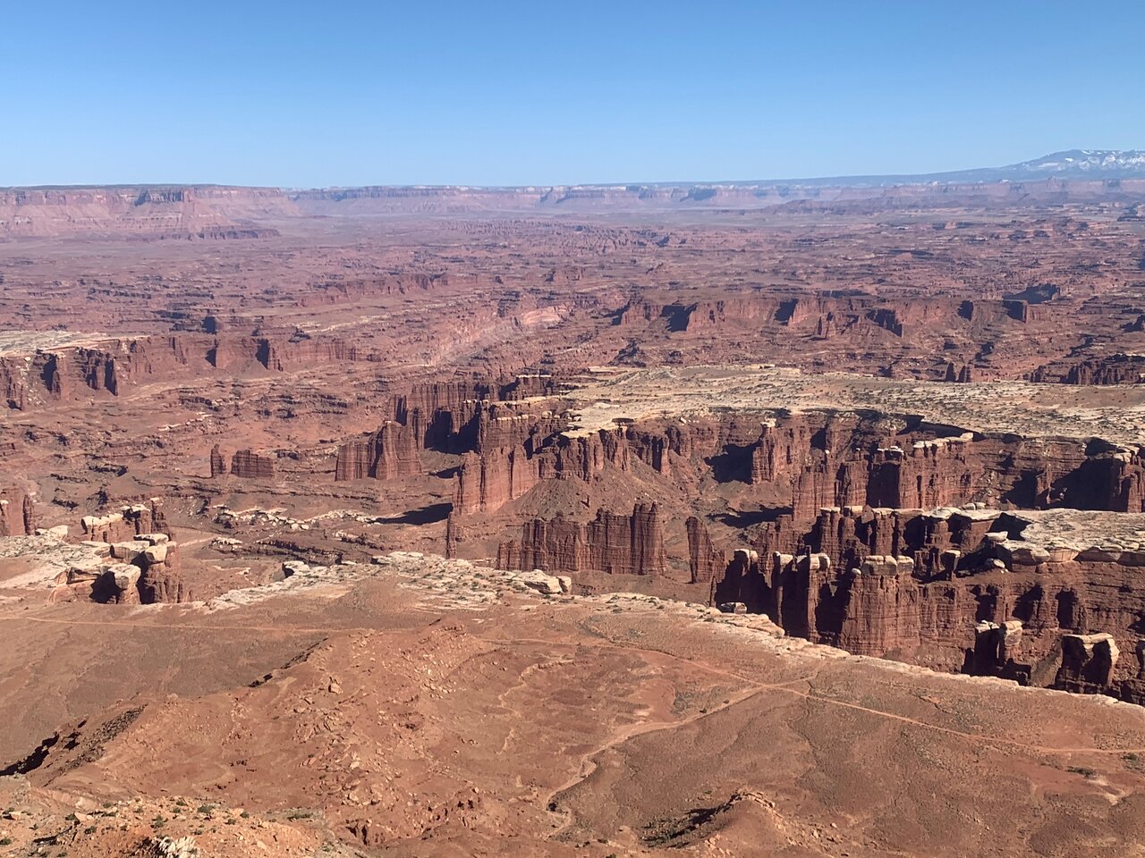
Buck Canyon Overlook
Here you’ll see spectacular views of Buck Canyon and the La Sal mountains. The short trail is paved, making it one of the most accessible places in the park. There’s also a rail that stands between you and the canyon, so if you are scared of heights, this overlook is perfect for you.
15
White Rim Overlook Trail
This is a great place to rest and enjoy a quick meal! There are only eight tables, so be sure to claim one if there are any available.
16
Orange Cliffs Overlook
The cowboys used the Orange Cliffs extensively. They called a part of these cliffs “Under the Ledge” — since it was a distinct area that sorta appeared to be underneath a huge, rocky ledge.
17
Grand View Point Overlook
We’re now at the end of the Canyonlands National Park tour. I hope you’ve enjoyed the journey! If you enjoyed the tour, check out our other tours of nearby Arches, Bryce, Zion, and more!
18
Upheaval Dome
Remember how the park’s rocks have been formed in layers? In most of the park, these layers haven’t been disrupted since their formation. What you see is what was deposited, all those hundreds of millions of years ago.
19
Murphy Point Trail
The trail that leads to Murphy Point Overlook is quite easy, adding up to 3.5 miles roundtrip. While the hike itself doesn’t offer much in the way of scenery, the overlook provides a stunning view of Stillwater Canyon and the Green River.
20
Canyonlands National Park
Canyonlands National Park in southeastern Utah is known for its dramatic desert landscape carved by the Colorado River. Island in the Sky is a huge, flat-topped mesa with panoramic overlooks. Other notable areas include the towering rock pinnacles known as the Needles, the remote canyons of the Maze, and the Native American rock paintings in Horseshoe Canyon. Whitewater rapids flow through Cataract Canyon.
21
Cataract Canyon
Cataract Canyon is a 46-mile-long canyon of the Colorado River located within Canyonlands National Park and Glen Canyon National Recreation Area in southern Utah.
22
Green River Overlook
The Green River Overlook offers some of the most unique views of Canyonland’s Island in the Sky District. You’re able to see the Green River continuing its work on the canyon walls. The river is the largest stream in Utah at 730 miles. The name probably comes from the green soapstone that can be found along its banks.
23
Island In The Sky Visitor Center
Stop by the Visitor Center coming up ahead. It’s a great place to grab supplies, use the bathroom, and fill up your water bottles. As you’ve already seen, this park doesn’t have much infrastructure, and being dehydrated out here is no joke.
24
Dead Horse Point State Park
Dead Horse Point — it’s a creepy name, isn’t it? According to local legend, wild mustangs used to be corralled here to be broken in the early 1800s. Once all the desirable horses had been broken and claimed by the cowboys, the undesirables were left to go free.
25
Corona Arch
Corona Arch is a natural sandstone arch near Moab. The arch is located within the same rock formation as Pinto Arch and Bowtie Arch.
26
Shafer Canyon Overlook
This overlook offers views from three sides. It may be a bit daunting if you're afraid of heights since there’s nothing between you and the Canyon. However, the incredible view is worth it.
27
Monitor and Merriamac Rock Formations
Look to the right. All you can see at the moment are tall rock walls. That’s because we’re near the floor of Sevenmile Canyon. As we continue to drive, we’ll emerge from the canyon and be able to see two very distinct features in the distance to the right -- the Merrimac and the Monitor.
28
Lathrop Canyon
A lot of natural landmarks and trails in Canyonlands are named by or after cowboys and ranchers. In fact, Ned Chaffin’s father and one of his brothers had a spring named after them.
29
Aztec Butte Trail
What makes this trail special? Simple: the granaries left here by Native peoples. They’re visible from the base of the last hill if you just keep your eyes open. These granaries are hundreds of years old, so be careful when approaching.
30
Whale Rock
In front of you is perhaps the world’s largest whale. Don’t see it? The whale’s head is on the left side of the rock. There’s an easy one-mile hike that takes you up along the whale’s back. When you get on top of this cetacean, you’ll be rewarded with spectacular views of the Upheaval Dome.
31
Mesa Arch
Ahead, pull over for Mesa Arch. This is a must-do at Canyonlands. Once you’ve parked, walk along the short trail to the arch. As you walk, notice the juniper and pinyon trees around you. These are popular in Canyonlands so keep an eye out for them elsewhere too.
32
Candlestick Tower Overlook
In the distance, do you see three giant candles sticking out of the landscape? That’s Candlestick Tower! Doesn’t this sandstone formation look like a layered birthday cake, topped with candles? * The bottom layer is white, the middle a reddish-brown, and the top is red.
33
Buck Canyon Overlook
Here you’ll see spectacular views of Buck Canyon and the La Sal mountains. The short trail is paved, making it one of the most accessible places in the park. There’s also a rail that stands between you and the canyon, so if you are scared of heights, this overlook is perfect for you.
34
White Rim Overlook Trail
This is a great place to rest and enjoy a quick meal! There are only eight tables, so be sure to claim one if there are any available.
35
Orange Cliffs Overlook
The cowboys used the Orange Cliffs extensively. They called a part of these cliffs “Under the Ledge” — since it was a distinct area that sorta appeared to be underneath a huge, rocky ledge.
36
Grand View Point Overlook
We’re now at the end of the Canyonlands National Park tour. I hope you’ve enjoyed the journey! If you enjoyed the tour, check out our other tours of nearby Arches, Bryce, Zion, and more!
37
Upheaval Dome
Remember how the park’s rocks have been formed in layers? In most of the park, these layers haven’t been disrupted since their formation. What you see is what was deposited, all those hundreds of millions of years ago.
38
Murphy Point Trail
The trail that leads to Murphy Point Overlook is quite easy, adding up to 3.5 miles roundtrip. While the hike itself doesn’t offer much in the way of scenery, the overlook provides a stunning view of Stillwater Canyon and the Green River.
39
Canyonlands National Park
Canyonlands National Park in southeastern Utah is known for its dramatic desert landscape carved by the Colorado River. Island in the Sky is a huge, flat-topped mesa with panoramic overlooks. Other notable areas include the towering rock pinnacles known as the Needles, the remote canyons of the Maze, and the Native American rock paintings in Horseshoe Canyon. Whitewater rapids flow through Cataract Canyon.
40
Cataract Canyon
Cataract Canyon is a 46-mile-long canyon of the Colorado River located within Canyonlands National Park and Glen Canyon National Recreation Area in southern Utah.
41
Green River Overlook
The Green River Overlook offers some of the most unique views of Canyonland’s Island in the Sky District. You’re able to see the Green River continuing its work on the canyon walls. The river is the largest stream in Utah at 730 miles. The name probably comes from the green soapstone that can be found along its banks.
42
Island In The Sky Visitor Center
Stop by the Visitor Center coming up ahead. It’s a great place to grab supplies, use the bathroom, and fill up your water bottles. As you’ve already seen, this park doesn’t have much infrastructure, and being dehydrated out here is no joke.
43
Dead Horse Point State Park
Dead Horse Point — it’s a creepy name, isn’t it? According to local legend, wild mustangs used to be corralled here to be broken in the early 1800s. Once all the desirable horses had been broken and claimed by the cowboys, the undesirables were left to go free.
44
Corona Arch
Corona Arch is a natural sandstone arch near Moab. The arch is located within the same rock formation as Pinto Arch and Bowtie Arch.
45
Shafer Canyon Overlook
This overlook offers views from three sides. It may be a bit daunting if you're afraid of heights since there’s nothing between you and the Canyon. However, the incredible view is worth it.
46
Monitor and Merriamac Rock Formations
Look to the right. All you can see at the moment are tall rock walls. That’s because we’re near the floor of Sevenmile Canyon. As we continue to drive, we’ll emerge from the canyon and be able to see two very distinct features in the distance to the right -- the Merrimac and the Monitor.
47
Lathrop Canyon
A lot of natural landmarks and trails in Canyonlands are named by or after cowboys and ranchers. In fact, Ned Chaffin’s father and one of his brothers had a spring named after them.
48
Aztec Butte Trail
What makes this trail special? Simple: the granaries left here by Native peoples. They’re visible from the base of the last hill if you just keep your eyes open. These granaries are hundreds of years old, so be careful when approaching.
49
Whale Rock
In front of you is perhaps the world’s largest whale. Don’t see it? The whale’s head is on the left side of the rock. There’s an easy one-mile hike that takes you up along the whale’s back. When you get on top of this cetacean, you’ll be rewarded with spectacular views of the Upheaval Dome.
50
Mesa Arch
Ahead, pull over for Mesa Arch. This is a must-do at Canyonlands. Once you’ve parked, walk along the short trail to the arch. As you walk, notice the juniper and pinyon trees around you. These are popular in Canyonlands so keep an eye out for them elsewhere too.
51
Candlestick Tower Overlook
In the distance, do you see three giant candles sticking out of the landscape? That’s Candlestick Tower! Doesn’t this sandstone formation look like a layered birthday cake, topped with candles? * The bottom layer is white, the middle a reddish-brown, and the top is red.
52
Buck Canyon Overlook
Here you’ll see spectacular views of Buck Canyon and the La Sal mountains. The short trail is paved, making it one of the most accessible places in the park. There’s also a rail that stands between you and the canyon, so if you are scared of heights, this overlook is perfect for you.
53
White Rim Overlook Trail
This is a great place to rest and enjoy a quick meal! There are only eight tables, so be sure to claim one if there are any available.
54
Orange Cliffs Overlook
The cowboys used the Orange Cliffs extensively. They called a part of these cliffs “Under the Ledge” — since it was a distinct area that sorta appeared to be underneath a huge, rocky ledge.
55
Grand View Point Overlook
We’re now at the end of the Canyonlands National Park tour. I hope you’ve enjoyed the journey! If you enjoyed the tour, check out our other tours of nearby Arches, Bryce, Zion, and more!
56
Upheaval Dome
Remember how the park’s rocks have been formed in layers? In most of the park, these layers haven’t been disrupted since their formation. What you see is what was deposited, all those hundreds of millions of years ago.
57
Murphy Point Trail
The trail that leads to Murphy Point Overlook is quite easy, adding up to 3.5 miles roundtrip. While the hike itself doesn’t offer much in the way of scenery, the overlook provides a stunning view of Stillwater Canyon and the Green River.
58
Canyonlands National Park
Canyonlands National Park in southeastern Utah is known for its dramatic desert landscape carved by the Colorado River. Island in the Sky is a huge, flat-topped mesa with panoramic overlooks. Other notable areas include the towering rock pinnacles known as the Needles, the remote canyons of the Maze, and the Native American rock paintings in Horseshoe Canyon. Whitewater rapids flow through Cataract Canyon.
59
Cataract Canyon
Cataract Canyon is a 46-mile-long canyon of the Colorado River located within Canyonlands National Park and Glen Canyon National Recreation Area in southern Utah.
60
Green River Overlook
The Green River Overlook offers some of the most unique views of Canyonland’s Island in the Sky District. You’re able to see the Green River continuing its work on the canyon walls. The river is the largest stream in Utah at 730 miles. The name probably comes from the green soapstone that can be found along its banks.
61
Island In The Sky Visitor Center
Stop by the Visitor Center coming up ahead. It’s a great place to grab supplies, use the bathroom, and fill up your water bottles. As you’ve already seen, this park doesn’t have much infrastructure, and being dehydrated out here is no joke.
62
Dead Horse Point State Park
Dead Horse Point — it’s a creepy name, isn’t it? According to local legend, wild mustangs used to be corralled here to be broken in the early 1800s. Once all the desirable horses had been broken and claimed by the cowboys, the undesirables were left to go free.
63
Corona Arch
Corona Arch is a natural sandstone arch near Moab. The arch is located within the same rock formation as Pinto Arch and Bowtie Arch.
64
Shafer Canyon Overlook
This overlook offers views from three sides. It may be a bit daunting if you're afraid of heights since there’s nothing between you and the Canyon. However, the incredible view is worth it.
65
Monitor and Merriamac Rock Formations
Look to the right. All you can see at the moment are tall rock walls. That’s because we’re near the floor of Sevenmile Canyon. As we continue to drive, we’ll emerge from the canyon and be able to see two very distinct features in the distance to the right -- the Merrimac and the Monitor.
66
Lathrop Canyon
A lot of natural landmarks and trails in Canyonlands are named by or after cowboys and ranchers. In fact, Ned Chaffin’s father and one of his brothers had a spring named after them.
67
Aztec Butte Trail
What makes this trail special? Simple: the granaries left here by Native peoples. They’re visible from the base of the last hill if you just keep your eyes open. These granaries are hundreds of years old, so be careful when approaching.
68
Whale Rock
In front of you is perhaps the world’s largest whale. Don’t see it? The whale’s head is on the left side of the rock. There’s an easy one-mile hike that takes you up along the whale’s back. When you get on top of this cetacean, you’ll be rewarded with spectacular views of the Upheaval Dome.
69
Mesa Arch
Ahead, pull over for Mesa Arch. This is a must-do at Canyonlands. Once you’ve parked, walk along the short trail to the arch. As you walk, notice the juniper and pinyon trees around you. These are popular in Canyonlands so keep an eye out for them elsewhere too.
70
Candlestick Tower Overlook
In the distance, do you see three giant candles sticking out of the landscape? That’s Candlestick Tower! Doesn’t this sandstone formation look like a layered birthday cake, topped with candles? * The bottom layer is white, the middle a reddish-brown, and the top is red.
71
Buck Canyon Overlook
Here you’ll see spectacular views of Buck Canyon and the La Sal mountains. The short trail is paved, making it one of the most accessible places in the park. There’s also a rail that stands between you and the canyon, so if you are scared of heights, this overlook is perfect for you.
72
White Rim Overlook Trail
This is a great place to rest and enjoy a quick meal! There are only eight tables, so be sure to claim one if there are any available.
73
Orange Cliffs Overlook
The cowboys used the Orange Cliffs extensively. They called a part of these cliffs “Under the Ledge” — since it was a distinct area that sorta appeared to be underneath a huge, rocky ledge.
74
Grand View Point Overlook
We’re now at the end of the Canyonlands National Park tour. I hope you’ve enjoyed the journey! If you enjoyed the tour, check out our other tours of nearby Arches, Bryce, Zion, and more!
75
Upheaval Dome
Remember how the park’s rocks have been formed in layers? In most of the park, these layers haven’t been disrupted since their formation. What you see is what was deposited, all those hundreds of millions of years ago.
76
Murphy Point Trail
The trail that leads to Murphy Point Overlook is quite easy, adding up to 3.5 miles roundtrip. While the hike itself doesn’t offer much in the way of scenery, the overlook provides a stunning view of Stillwater Canyon and the Green River.
77
Canyonlands National Park
Canyonlands National Park in southeastern Utah is known for its dramatic desert landscape carved by the Colorado River. Island in the Sky is a huge, flat-topped mesa with panoramic overlooks. Other notable areas include the towering rock pinnacles known as the Needles, the remote canyons of the Maze, and the Native American rock paintings in Horseshoe Canyon. Whitewater rapids flow through Cataract Canyon.
78
Cataract Canyon
Cataract Canyon is a 46-mile-long canyon of the Colorado River located within Canyonlands National Park and Glen Canyon National Recreation Area in southern Utah.
79
Green River Overlook
The Green River Overlook offers some of the most unique views of Canyonland’s Island in the Sky District. You’re able to see the Green River continuing its work on the canyon walls. The river is the largest stream in Utah at 730 miles. The name probably comes from the green soapstone that can be found along its banks.
80
Island In The Sky Visitor Center
Stop by the Visitor Center coming up ahead. It’s a great place to grab supplies, use the bathroom, and fill up your water bottles. As you’ve already seen, this park doesn’t have much infrastructure, and being dehydrated out here is no joke.
81
Dead Horse Point State Park
Dead Horse Point — it’s a creepy name, isn’t it? According to local legend, wild mustangs used to be corralled here to be broken in the early 1800s. Once all the desirable horses had been broken and claimed by the cowboys, the undesirables were left to go free.
82
Corona Arch
Corona Arch is a natural sandstone arch near Moab. The arch is located within the same rock formation as Pinto Arch and Bowtie Arch.
83
Shafer Canyon Overlook
This overlook offers views from three sides. It may be a bit daunting if you're afraid of heights since there’s nothing between you and the Canyon. However, the incredible view is worth it.
84
Monitor and Merriamac Rock Formations
Look to the right. All you can see at the moment are tall rock walls. That’s because we’re near the floor of Sevenmile Canyon. As we continue to drive, we’ll emerge from the canyon and be able to see two very distinct features in the distance to the right -- the Merrimac and the Monitor.
85
Lathrop Canyon
A lot of natural landmarks and trails in Canyonlands are named by or after cowboys and ranchers. In fact, Ned Chaffin’s father and one of his brothers had a spring named after them.
86
Aztec Butte Trail
What makes this trail special? Simple: the granaries left here by Native peoples. They’re visible from the base of the last hill if you just keep your eyes open. These granaries are hundreds of years old, so be careful when approaching.
87
Whale Rock
In front of you is perhaps the world’s largest whale. Don’t see it? The whale’s head is on the left side of the rock. There’s an easy one-mile hike that takes you up along the whale’s back. When you get on top of this cetacean, you’ll be rewarded with spectacular views of the Upheaval Dome.
88
Mesa Arch
Ahead, pull over for Mesa Arch. This is a must-do at Canyonlands. Once you’ve parked, walk along the short trail to the arch. As you walk, notice the juniper and pinyon trees around you. These are popular in Canyonlands so keep an eye out for them elsewhere too.
89
Candlestick Tower Overlook
In the distance, do you see three giant candles sticking out of the landscape? That’s Candlestick Tower! Doesn’t this sandstone formation look like a layered birthday cake, topped with candles? * The bottom layer is white, the middle a reddish-brown, and the top is red.
90
Buck Canyon Overlook
Here you’ll see spectacular views of Buck Canyon and the La Sal mountains. The short trail is paved, making it one of the most accessible places in the park. There’s also a rail that stands between you and the canyon, so if you are scared of heights, this overlook is perfect for you.
91
White Rim Overlook Trail
This is a great place to rest and enjoy a quick meal! There are only eight tables, so be sure to claim one if there are any available.
92
Orange Cliffs Overlook
The cowboys used the Orange Cliffs extensively. They called a part of these cliffs “Under the Ledge” — since it was a distinct area that sorta appeared to be underneath a huge, rocky ledge.
93
Grand View Point Overlook
We’re now at the end of the Canyonlands National Park tour. I hope you’ve enjoyed the journey! If you enjoyed the tour, check out our other tours of nearby Arches, Bryce, Zion, and more!
94
Upheaval Dome
Remember how the park’s rocks have been formed in layers? In most of the park, these layers haven’t been disrupted since their formation. What you see is what was deposited, all those hundreds of millions of years ago.
95
Murphy Point Trail
The trail that leads to Murphy Point Overlook is quite easy, adding up to 3.5 miles roundtrip. While the hike itself doesn’t offer much in the way of scenery, the overlook provides a stunning view of Stillwater Canyon and the Green River.
96
Национальный парк Каньонлендс
Национальный парк Каньонлендс на юго-востоке штата Юта известен своим драматическим пустынным ландшафтом, вырезанным рекой Колорадо. Остров в небе — это огромная гора с плоской вершиной и панорамным видом. Другие известные районы включают возвышающиеся скальные вершины, известные как Иглы, отдаленные каньоны Лабиринта и наскальные рисунки коренных американцев в каньоне Подкова. Пороги Уайтуотер протекают через каньон Катаракт.
97
Каньон Катаракты
Каньон Катаракт — каньон реки Колорадо длиной 46 миль, расположенный на территории национального парка Каньонлендс и национальной зоны отдыха Глен-Каньон в южной части штата Юта.
98
Вид на Грин-Ривер
С смотровой площадки Грин-Ривер открывается один из самых уникальных видов на остров Каньонленд в районе Скай. Вы можете видеть, как Грин-Ривер продолжает свою работу на стенах каньона. Река является крупнейшим потоком в штате Юта на 730 миль. Название, вероятно, происходит от зеленого мыльного камня, который можно найти на его берегах.
99
Центр посетителей острова в небе
Остановитесь в Центре для посетителей впереди. Это отличное место, чтобы взять припасы, сходить в туалет и наполнить бутылки с водой. Как вы уже видели, в этом парке не очень развита инфраструктура, и обезвоживание здесь — не шутка.
100
Государственный парк Dead Horse Point
Dead Horse Point — жуткое название, не правда ли? Согласно местной легенде, в начале 1800-х годов здесь загоняли диких мустангов, чтобы их разбили. Как только все желанные лошади были сломаны и забраны ковбоями, нежелательные остались на свободе.
101
Корона Арка
Арка Короны — это естественная арка из песчаника недалеко от Моава. Арка расположена в том же скальном образовании, что и Арка Пинто и Арка Боути.
102
Вид на каньон Шафер
С этой смотровой площадки открывается вид с трех сторон. Это может быть немного сложно, если вы боитесь высоты, поскольку между вами и Каньоном ничего нет. Однако невероятный вид того стоит.
103
Скальные образования Монитор и Мерримак
Посмотрите направо. Все, что вы можете видеть в данный момент, это высокие каменные стены. Это потому, что мы находимся у дна Семимильного каньона. Продолжая движение, мы выйдем из каньона и сможем увидеть две очень отчетливые детали на расстоянии справа — Мерримак и Монитор.
104
Каньон Латроп
Многие природные достопримечательности и тропы в Каньонлендсе названы в честь ковбоев и владельцев ранчо. Фактически, в честь отца Неда Чаффина и одного из его братьев был назван источник.
105
Ацтекская тропа Бьютт
Что делает этот маршрут особенным? Просто: зернохранилища, оставленные здесь коренными народами. Их видно с подножия последнего холма, если просто держать глаза открытыми. Этим зернохранилищам сотни лет, поэтому будьте осторожны при приближении.
106
Китовая скала
Перед вами, пожалуй, самый большой в мире кит. Не видите? Голова кита находится на левой стороне скалы. Есть легкий поход длиной в одну милю, который проведет вас вдоль спины кита. Когда вы окажетесь на вершине этого китообразного, вы будете вознаграждены захватывающим видом на купол Upheaval.
107
Арка Меса
Впереди остановитесь у Mesa Arch. Это то, что нужно сделать в Canyonlands. Припарковавшись, идите по короткой тропе к арке. Во время прогулки обратите внимание на можжевельник и сосновые деревья вокруг вас. Они популярны в Каньонленде, поэтому следите за ними и в других местах.
108
Подсвечник с видом на башню
Вы видите вдалеке три гигантские свечи, торчащие из пейзажа? Это Свечная башня! Разве это образование из песчаника не похоже на многослойный торт ко дню рождения, увенчанный свечами? * Нижний слой белый, средний красновато-коричневый, верхний красный.
109
Вид на Бак-Каньон
Здесь вы увидите захватывающий вид на Бак-Каньон и горы Ла-Саль. Короткая тропа вымощена, что делает ее одним из самых доступных мест в парке. Между вами и каньоном также есть перила, поэтому, если вы боитесь высоты, этот обзор идеально подходит для вас.
110
Белая тропа с видом на край
Это отличное место, чтобы отдохнуть и насладиться быстрой едой! Есть только восемь столов, поэтому обязательно закажите один, если они есть.
111
Вид на Оранжевые скалы
Ковбои широко использовали Оранжевые скалы. Они назвали часть этих утесов «Под уступом» — поскольку это была отдельная область, которая как бы находилась под огромным скалистым уступом.
112
Гранд Вью Пойнт Оверлук
Мы подошли к концу тура по национальному парку Каньонлендс. Надеюсь, вам понравилось путешествие! Если вам понравился тур, ознакомьтесь с другими нашими турами по близлежащим Аркам, Брайсу, Сиону и другим местам!
113
Купол переворота
Помните, как скалы в парке формировались слоями? На большей части парка эти слои не нарушались с момента их образования. То, что вы видите, это то, что было отложено сотни миллионов лет назад.
114
Тропа Мерфи-Пойнт
Тропа, ведущая к смотровой площадке Мерфи-Пойнт, довольно проста, в сумме она составляет до 3,5 миль туда и обратно. В то время как сам поход не предлагает много пейзажей, открывается потрясающий вид на каньон Стилуотер и реку Грин.
115
Canyonlands National Park
Canyonlands National Park in southeastern Utah is known for its dramatic desert landscape carved by the Colorado River. Island in the Sky is a huge, flat-topped mesa with panoramic overlooks. Other notable areas include the towering rock pinnacles known as the Needles, the remote canyons of the Maze, and the Native American rock paintings in Horseshoe Canyon. Whitewater rapids flow through Cataract Canyon. Note: This 62+ mile-long tour covers the essentials of Canyonlands National Park in 2-3 hours. Buy once, use for one year! Ideal for extended visits and return trips over the next 12 months.
116
Cataract Canyon
Cataract Canyon is a 46-mile-long canyon of the Colorado River located within Canyonlands National Park and Glen Canyon National Recreation Area in southern Utah.
117
Green River Overlook
The Green River Overlook offers some of the most unique views of Canyonland’s Island in the Sky District. You’re able to see the Green River continuing its work on the canyon walls. The river is the largest stream in Utah at 730 miles. The name probably comes from the green soapstone that can be found along its banks.
118
Island in the Sky
Stop by the Visitor Center coming up ahead. It’s a great place to grab supplies, use the bathroom, and fill up your water bottles. As you’ve already seen, this park doesn’t have much infrastructure, and being dehydrated out here is no joke.
119
Dead Horse Point State Park
Dead Horse Point — it’s a creepy name, isn’t it? According to local legend, wild mustangs used to be corralled here to be broken in the early 1800s. Once all the desirable horses had been broken and claimed by the cowboys, the undesirables were left to go free.
120
Corona Arch Trail
Corona Arch is a natural sandstone arch near Moab. The arch is located within the same rock formation as Pinto Arch and Bowtie Arch.
121
Shafer Canyon Overlook
This overlook offers views from three sides. It may be a bit daunting if you're afraid of heights since there’s nothing between you and the Canyon. However, the incredible view is worth it.
122
Monitor and Merriamac Rock Formations
Look to the right. All you can see at the moment are tall rock walls. That’s because we’re near the floor of Sevenmile Canyon. As we continue to drive, we’ll emerge from the canyon and be able to see two very distinct features in the distance to the right -- the Merrimac and the Monitor.
123
Lathrop Canyon
A lot of natural landmarks and trails in Canyonlands are named by or after cowboys and ranchers. In fact, Ned Chaffin’s father and one of his brothers had a spring named after them.
124
Aztec Butte Trail
What makes this trail special? Simple: the granaries left here by Native peoples. They’re visible from the base of the last hill if you just keep your eyes open. These granaries are hundreds of years old, so be careful when approaching.
125
Whale Rock
In front of you is perhaps the world’s largest whale. Don’t see it? The whale’s head is on the left side of the rock. There’s an easy one-mile hike that takes you up along the whale’s back. When you get on top of this cetacean, you’ll be rewarded with spectacular views of the Upheaval Dome.
126
Mesa Arch
Ahead, pull over for Mesa Arch. This is a must-do at Canyonlands. Once you’ve parked, walk along the short trail to the arch. As you walk, notice the juniper and pinyon trees around you. These are popular in Canyonlands so keep an eye out for them elsewhere too.
127
Candlestick Tower Overlook
In the distance, do you see three giant candles sticking out of the landscape? That’s Candlestick Tower! Doesn’t this sandstone formation look like a layered birthday cake, topped with candles? * The bottom layer is white, the middle a reddish-brown, and the top is red.
128
Buck Canyon Overlook
Here you’ll see spectacular views of Buck Canyon and the La Sal mountains. The short trail is paved, making it one of the most accessible places in the park. There’s also a rail that stands between you and the canyon, so if you are scared of heights, this overlook is perfect for you.
129
White Rim Overlook Trail
This is a great place to rest and enjoy a quick meal! There are only eight tables, so be sure to claim one if there are any available.
130
Orange Cliffs Overlook
The cowboys used the Orange Cliffs extensively. They called a part of these cliffs “Under the Ledge” — since it was a distinct area that sorta appeared to be underneath a huge, rocky ledge.
131
Grand View Point Overlook
We’re now at the end of the Canyonlands National Park tour. I hope you’ve enjoyed the journey! If you enjoyed the tour, check out our other tours of nearby Arches, Bryce, Zion, and more!
132
Upheaval Dome
Remember how the park’s rocks have been formed in layers? In most of the park, these layers haven’t been disrupted since their formation. What you see is what was deposited, all those hundreds of millions of years ago.
133
Murphy Point Trail
The trail that leads to Murphy Point Overlook is quite easy, adding up to 3.5 miles roundtrip. While the hike itself doesn’t offer much in the way of scenery, the overlook provides a stunning view of Stillwater Canyon and the Green River.
134
Canyonlands National Park
Canyonlands National Park in southeastern Utah is known for its dramatic desert landscape carved by the Colorado River. Island in the Sky is a huge, flat-topped mesa with panoramic overlooks. Other notable areas include the towering rock pinnacles known as the Needles, the remote canyons of the Maze, and the Native American rock paintings in Horseshoe Canyon. Whitewater rapids flow through Cataract Canyon. Note: This 62+ mile-long tour covers the essentials of Canyonlands National Park in 2-3 hours. Buy once, use for one year! Ideal for extended visits and return trips over the next 12 months.
135
Cataract Canyon
Cataract Canyon is a 46-mile-long canyon of the Colorado River located within Canyonlands National Park and Glen Canyon National Recreation Area in southern Utah.
136
Green River Overlook
The Green River Overlook offers some of the most unique views of Canyonland’s Island in the Sky District. You’re able to see the Green River continuing its work on the canyon walls. The river is the largest stream in Utah at 730 miles. The name probably comes from the green soapstone that can be found along its banks.
137
Island in the Sky
Stop by the Visitor Center coming up ahead. It’s a great place to grab supplies, use the bathroom, and fill up your water bottles. As you’ve already seen, this park doesn’t have much infrastructure, and being dehydrated out here is no joke.
138
Dead Horse Point State Park
Dead Horse Point — it’s a creepy name, isn’t it? According to local legend, wild mustangs used to be corralled here to be broken in the early 1800s. Once all the desirable horses had been broken and claimed by the cowboys, the undesirables were left to go free.
139
Corona Arch Trail
Corona Arch is a natural sandstone arch near Moab. The arch is located within the same rock formation as Pinto Arch and Bowtie Arch.
140
Shafer Canyon Overlook
This overlook offers views from three sides. It may be a bit daunting if you're afraid of heights since there’s nothing between you and the Canyon. However, the incredible view is worth it.
141
Monitor and Merriamac Rock Formations
Look to the right. All you can see at the moment are tall rock walls. That’s because we’re near the floor of Sevenmile Canyon. As we continue to drive, we’ll emerge from the canyon and be able to see two very distinct features in the distance to the right -- the Merrimac and the Monitor.
142
Lathrop Canyon
A lot of natural landmarks and trails in Canyonlands are named by or after cowboys and ranchers. In fact, Ned Chaffin’s father and one of his brothers had a spring named after them.
143
Aztec Butte Trail
What makes this trail special? Simple: the granaries left here by Native peoples. They’re visible from the base of the last hill if you just keep your eyes open. These granaries are hundreds of years old, so be careful when approaching.
144
Whale Rock
In front of you is perhaps the world’s largest whale. Don’t see it? The whale’s head is on the left side of the rock. There’s an easy one-mile hike that takes you up along the whale’s back. When you get on top of this cetacean, you’ll be rewarded with spectacular views of the Upheaval Dome.
145
Mesa Arch
Ahead, pull over for Mesa Arch. This is a must-do at Canyonlands. Once you’ve parked, walk along the short trail to the arch. As you walk, notice the juniper and pinyon trees around you. These are popular in Canyonlands so keep an eye out for them elsewhere too.
146
Candlestick Tower Overlook
In the distance, do you see three giant candles sticking out of the landscape? That’s Candlestick Tower! Doesn’t this sandstone formation look like a layered birthday cake, topped with candles? * The bottom layer is white, the middle a reddish-brown, and the top is red.
147
Buck Canyon Overlook
Here you’ll see spectacular views of Buck Canyon and the La Sal mountains. The short trail is paved, making it one of the most accessible places in the park. There’s also a rail that stands between you and the canyon, so if you are scared of heights, this overlook is perfect for you.
148
White Rim Overlook Trail
This is a great place to rest and enjoy a quick meal! There are only eight tables, so be sure to claim one if there are any available.
149
Orange Cliffs Overlook
The cowboys used the Orange Cliffs extensively. They called a part of these cliffs “Under the Ledge” — since it was a distinct area that sorta appeared to be underneath a huge, rocky ledge.
150
Grand View Point Overlook
We’re now at the end of the Canyonlands National Park tour. I hope you’ve enjoyed the journey! If you enjoyed the tour, check out our other tours of nearby Arches, Bryce, Zion, and more!
151
Upheaval Dome
Remember how the park’s rocks have been formed in layers? In most of the park, these layers haven’t been disrupted since their formation. What you see is what was deposited, all those hundreds of millions of years ago.
152
Murphy Point Trail
The trail that leads to Murphy Point Overlook is quite easy, adding up to 3.5 miles roundtrip. While the hike itself doesn’t offer much in the way of scenery, the overlook provides a stunning view of Stillwater Canyon and the Green River.
153
Canyonlands National Park
Canyonlands National Park in southeastern Utah is known for its dramatic desert landscape carved by the Colorado River. Island in the Sky is a huge, flat-topped mesa with panoramic overlooks. Other notable areas include the towering rock pinnacles known as the Needles, the remote canyons of the Maze, and the Native American rock paintings in Horseshoe Canyon. Whitewater rapids flow through Cataract Canyon. Note: This 62+ mile-long tour covers the essentials of Canyonlands National Park in 2-3 hours. Buy once, use for one year! Ideal for extended visits and return trips over the next 12 months.
154
Cataract Canyon
Cataract Canyon is a 46-mile-long canyon of the Colorado River located within Canyonlands National Park and Glen Canyon National Recreation Area in southern Utah.
155
Green River Overlook
The Green River Overlook offers some of the most unique views of Canyonland’s Island in the Sky District. You’re able to see the Green River continuing its work on the canyon walls. The river is the largest stream in Utah at 730 miles. The name probably comes from the green soapstone that can be found along its banks.
156
Island in the Sky
Stop by the Visitor Center coming up ahead. It’s a great place to grab supplies, use the bathroom, and fill up your water bottles. As you’ve already seen, this park doesn’t have much infrastructure, and being dehydrated out here is no joke.
157
Dead Horse Point State Park
Dead Horse Point — it’s a creepy name, isn’t it? According to local legend, wild mustangs used to be corralled here to be broken in the early 1800s. Once all the desirable horses had been broken and claimed by the cowboys, the undesirables were left to go free.
158
Corona Arch Trail
Corona Arch is a natural sandstone arch near Moab. The arch is located within the same rock formation as Pinto Arch and Bowtie Arch.
159
Shafer Canyon Overlook
This overlook offers views from three sides. It may be a bit daunting if you're afraid of heights since there’s nothing between you and the Canyon. However, the incredible view is worth it.
160
Monitor and Merriamac Rock Formations
Look to the right. All you can see at the moment are tall rock walls. That’s because we’re near the floor of Sevenmile Canyon. As we continue to drive, we’ll emerge from the canyon and be able to see two very distinct features in the distance to the right -- the Merrimac and the Monitor.
161
Lathrop Canyon
A lot of natural landmarks and trails in Canyonlands are named by or after cowboys and ranchers. In fact, Ned Chaffin’s father and one of his brothers had a spring named after them.
162
Aztec Butte Trail
What makes this trail special? Simple: the granaries left here by Native peoples. They’re visible from the base of the last hill if you just keep your eyes open. These granaries are hundreds of years old, so be careful when approaching.
163
Whale Rock
In front of you is perhaps the world’s largest whale. Don’t see it? The whale’s head is on the left side of the rock. There’s an easy one-mile hike that takes you up along the whale’s back. When you get on top of this cetacean, you’ll be rewarded with spectacular views of the Upheaval Dome.
164
Mesa Arch
Ahead, pull over for Mesa Arch. This is a must-do at Canyonlands. Once you’ve parked, walk along the short trail to the arch. As you walk, notice the juniper and pinyon trees around you. These are popular in Canyonlands so keep an eye out for them elsewhere too.
165
Candlestick Tower Overlook
In the distance, do you see three giant candles sticking out of the landscape? That’s Candlestick Tower! Doesn’t this sandstone formation look like a layered birthday cake, topped with candles? * The bottom layer is white, the middle a reddish-brown, and the top is red.
166
Buck Canyon Overlook
Here you’ll see spectacular views of Buck Canyon and the La Sal mountains. The short trail is paved, making it one of the most accessible places in the park. There’s also a rail that stands between you and the canyon, so if you are scared of heights, this overlook is perfect for you.
167
White Rim Overlook Trail
This is a great place to rest and enjoy a quick meal! There are only eight tables, so be sure to claim one if there are any available.
168
Orange Cliffs Overlook
The cowboys used the Orange Cliffs extensively. They called a part of these cliffs “Under the Ledge” — since it was a distinct area that sorta appeared to be underneath a huge, rocky ledge.
169
Grand View Point Overlook
We’re now at the end of the Canyonlands National Park tour. I hope you’ve enjoyed the journey! If you enjoyed the tour, check out our other tours of nearby Arches, Bryce, Zion, and more!
170
Upheaval Dome
Remember how the park’s rocks have been formed in layers? In most of the park, these layers haven’t been disrupted since their formation. What you see is what was deposited, all those hundreds of millions of years ago.
171
Murphy Point Trail
The trail that leads to Murphy Point Overlook is quite easy, adding up to 3.5 miles roundtrip. While the hike itself doesn’t offer much in the way of scenery, the overlook provides a stunning view of Stillwater Canyon and the Green River.
172
Canyonlands National Park
Canyonlands National Park in southeastern Utah is known for its dramatic desert landscape carved by the Colorado River. Island in the Sky is a huge, flat-topped mesa with panoramic overlooks. Other notable areas include the towering rock pinnacles known as the Needles, the remote canyons of the Maze, and the Native American rock paintings in Horseshoe Canyon. Whitewater rapids flow through Cataract Canyon. Note: This 62+ mile-long tour covers the essentials of Canyonlands National Park in 2-3 hours. Buy once, use for one year! Ideal for extended visits and return trips over the next 12 months.
173
Cataract Canyon
Cataract Canyon is a 46-mile-long canyon of the Colorado River located within Canyonlands National Park and Glen Canyon National Recreation Area in southern Utah.
174
Green River Overlook
The Green River Overlook offers some of the most unique views of Canyonland’s Island in the Sky District. You’re able to see the Green River continuing its work on the canyon walls. The river is the largest stream in Utah at 730 miles. The name probably comes from the green soapstone that can be found along its banks.
175
Island in the Sky
Stop by the Visitor Center coming up ahead. It’s a great place to grab supplies, use the bathroom, and fill up your water bottles. As you’ve already seen, this park doesn’t have much infrastructure, and being dehydrated out here is no joke.
176
Dead Horse Point State Park
Dead Horse Point — it’s a creepy name, isn’t it? According to local legend, wild mustangs used to be corralled here to be broken in the early 1800s. Once all the desirable horses had been broken and claimed by the cowboys, the undesirables were left to go free.
177
Corona Arch Trail
Corona Arch is a natural sandstone arch near Moab. The arch is located within the same rock formation as Pinto Arch and Bowtie Arch.
178
Shafer Canyon Overlook
This overlook offers views from three sides. It may be a bit daunting if you're afraid of heights since there’s nothing between you and the Canyon. However, the incredible view is worth it.
179
Monitor and Merriamac Rock Formations
Look to the right. All you can see at the moment are tall rock walls. That’s because we’re near the floor of Sevenmile Canyon. As we continue to drive, we’ll emerge from the canyon and be able to see two very distinct features in the distance to the right -- the Merrimac and the Monitor.
180
Lathrop Canyon
A lot of natural landmarks and trails in Canyonlands are named by or after cowboys and ranchers. In fact, Ned Chaffin’s father and one of his brothers had a spring named after them.
181
Aztec Butte Trail
What makes this trail special? Simple: the granaries left here by Native peoples. They’re visible from the base of the last hill if you just keep your eyes open. These granaries are hundreds of years old, so be careful when approaching.
182
Whale Rock
In front of you is perhaps the world’s largest whale. Don’t see it? The whale’s head is on the left side of the rock. There’s an easy one-mile hike that takes you up along the whale’s back. When you get on top of this cetacean, you’ll be rewarded with spectacular views of the Upheaval Dome.
183
Mesa Arch
Ahead, pull over for Mesa Arch. This is a must-do at Canyonlands. Once you’ve parked, walk along the short trail to the arch. As you walk, notice the juniper and pinyon trees around you. These are popular in Canyonlands so keep an eye out for them elsewhere too.
184
Candlestick Tower Overlook
In the distance, do you see three giant candles sticking out of the landscape? That’s Candlestick Tower! Doesn’t this sandstone formation look like a layered birthday cake, topped with candles? * The bottom layer is white, the middle a reddish-brown, and the top is red.
185
Buck Canyon Overlook
Here you’ll see spectacular views of Buck Canyon and the La Sal mountains. The short trail is paved, making it one of the most accessible places in the park. There’s also a rail that stands between you and the canyon, so if you are scared of heights, this overlook is perfect for you.
186
White Rim Overlook Trail
This is a great place to rest and enjoy a quick meal! There are only eight tables, so be sure to claim one if there are any available.
187
Orange Cliffs Overlook
The cowboys used the Orange Cliffs extensively. They called a part of these cliffs “Under the Ledge” — since it was a distinct area that sorta appeared to be underneath a huge, rocky ledge.
188
Grand View Point Overlook
We’re now at the end of the Canyonlands National Park tour. I hope you’ve enjoyed the journey! If you enjoyed the tour, check out our other tours of nearby Arches, Bryce, Zion, and more!
189
Upheaval Dome
Remember how the park’s rocks have been formed in layers? In most of the park, these layers haven’t been disrupted since their formation. What you see is what was deposited, all those hundreds of millions of years ago.
190
Murphy Point Trail
The trail that leads to Murphy Point Overlook is quite easy, adding up to 3.5 miles roundtrip. While the hike itself doesn’t offer much in the way of scenery, the overlook provides a stunning view of Stillwater Canyon and the Green River.
191
Canyonlands National Park
Canyonlands National Park in southeastern Utah is known for its dramatic desert landscape carved by the Colorado River. Island in the Sky is a huge, flat-topped mesa with panoramic overlooks. Other notable areas include the towering rock pinnacles known as the Needles, the remote canyons of the Maze, and the Native American rock paintings in Horseshoe Canyon. Whitewater rapids flow through Cataract Canyon. Note: This 62+ mile-long tour covers the essentials of Canyonlands National Park in 2-3 hours. Buy once, use for one year! Ideal for extended visits and return trips over the next 12 months.
192
Cataract Canyon
Cataract Canyon is a 46-mile-long canyon of the Colorado River located within Canyonlands National Park and Glen Canyon National Recreation Area in southern Utah.
193
Green River Overlook
The Green River Overlook offers some of the most unique views of Canyonland’s Island in the Sky District. You’re able to see the Green River continuing its work on the canyon walls. The river is the largest stream in Utah at 730 miles. The name probably comes from the green soapstone that can be found along its banks.
194
Island in the Sky
Stop by the Visitor Center coming up ahead. It’s a great place to grab supplies, use the bathroom, and fill up your water bottles. As you’ve already seen, this park doesn’t have much infrastructure, and being dehydrated out here is no joke.
195
Dead Horse Point State Park
Dead Horse Point — it’s a creepy name, isn’t it? According to local legend, wild mustangs used to be corralled here to be broken in the early 1800s. Once all the desirable horses had been broken and claimed by the cowboys, the undesirables were left to go free.
196
Corona Arch Trail
Corona Arch is a natural sandstone arch near Moab. The arch is located within the same rock formation as Pinto Arch and Bowtie Arch.
197
Shafer Canyon Overlook
This overlook offers views from three sides. It may be a bit daunting if you're afraid of heights since there’s nothing between you and the Canyon. However, the incredible view is worth it.
198
Monitor and Merriamac Rock Formations
Look to the right. All you can see at the moment are tall rock walls. That’s because we’re near the floor of Sevenmile Canyon. As we continue to drive, we’ll emerge from the canyon and be able to see two very distinct features in the distance to the right -- the Merrimac and the Monitor.
199
Lathrop Canyon
A lot of natural landmarks and trails in Canyonlands are named by or after cowboys and ranchers. In fact, Ned Chaffin’s father and one of his brothers had a spring named after them.
200
Aztec Butte Trail
What makes this trail special? Simple: the granaries left here by Native peoples. They’re visible from the base of the last hill if you just keep your eyes open. These granaries are hundreds of years old, so be careful when approaching.
201
Whale Rock
In front of you is perhaps the world’s largest whale. Don’t see it? The whale’s head is on the left side of the rock. There’s an easy one-mile hike that takes you up along the whale’s back. When you get on top of this cetacean, you’ll be rewarded with spectacular views of the Upheaval Dome.
202
Mesa Arch
Ahead, pull over for Mesa Arch. This is a must-do at Canyonlands. Once you’ve parked, walk along the short trail to the arch. As you walk, notice the juniper and pinyon trees around you. These are popular in Canyonlands so keep an eye out for them elsewhere too.
203
Candlestick Tower Overlook
In the distance, do you see three giant candles sticking out of the landscape? That’s Candlestick Tower! Doesn’t this sandstone formation look like a layered birthday cake, topped with candles? * The bottom layer is white, the middle a reddish-brown, and the top is red.
204
Buck Canyon Overlook
Here you’ll see spectacular views of Buck Canyon and the La Sal mountains. The short trail is paved, making it one of the most accessible places in the park. There’s also a rail that stands between you and the canyon, so if you are scared of heights, this overlook is perfect for you.
205
White Rim Overlook Trail
This is a great place to rest and enjoy a quick meal! There are only eight tables, so be sure to claim one if there are any available.
206
Orange Cliffs Overlook
The cowboys used the Orange Cliffs extensively. They called a part of these cliffs “Under the Ledge” — since it was a distinct area that sorta appeared to be underneath a huge, rocky ledge.
207
Grand View Point Overlook
We’re now at the end of the Canyonlands National Park tour. I hope you’ve enjoyed the journey! If you enjoyed the tour, check out our other tours of nearby Arches, Bryce, Zion, and more!
208
Upheaval Dome
Remember how the park’s rocks have been formed in layers? In most of the park, these layers haven’t been disrupted since their formation. What you see is what was deposited, all those hundreds of millions of years ago.
209
Murphy Point Trail
The trail that leads to Murphy Point Overlook is quite easy, adding up to 3.5 miles roundtrip. While the hike itself doesn’t offer much in the way of scenery, the overlook provides a stunning view of Stillwater Canyon and the Green River.
Показать 206 больше остановок
Политика отмены
For a full refund, cancel at least 24 hours before the scheduled departure time.
Фотографии путешественников
Отзывы (45)
Bernadettte_B
Jun 2021
The audio tour added so much information to our trip to Canyonlands! I think we got much more from our trip because of the audio guide.
Ответ от хоста
Jun 2021
Awesome, thank you so much! So glad you enjoyed your trip through Canyonlands with our self-guided tour. Are you also visiting Arches (next door) or Utah’s other parks? We have similar self-guided tours for all of them — ActionTourGuide.com.
Stephanie_L
May 2021
Easy to download before the trip and use along our drive. Would use this app again for another driving tour.
Ответ от хоста
Jun 2021
Wow, thank you so much!! So glad you enjoyed it! We have similar self-guided tours for Arches, Bryce, Zion, Grand Staircase Escalante, etc available on our website. Hopefully, you get the chance to use some of these in the future!
Charles_Y
May 2021
I liked the way the app followed your progress, and would start the narration as you approached your destination. The only downside was the beginning. It should be renamed the dinosaur park, instead of the Moab Giants. They are the smallest things in the area.
Ответ от хоста
May 2021
Wow, thank you so much!! So glad you enjoyed it! We’ll definitely think about clarifying the Moab Giants (the official name) in the next update. We have similar self-guided tours for Arches, Bryce, Zion, Grand Staircase Escalante, etc available on our website. Hopefully, you get the chance to use some of these in the future!

Связанные события

События в том же районе

Мы думаем, что ваш язык English
На каком языке вы хотели бы видеть эту страницу?
English English
Мы думаем, что ваш город Нью-Йорк
В каком городе вы бы хотели исследовать?
Нью-Йорк
New York City